Political maps
Political Maps show governmental and administrative borders of countries, provinces, states, and counties, the location of major cities, and other political units.

Countries that permit and forbid multiple citizenship
Reddit user: SwiftOryx
Read More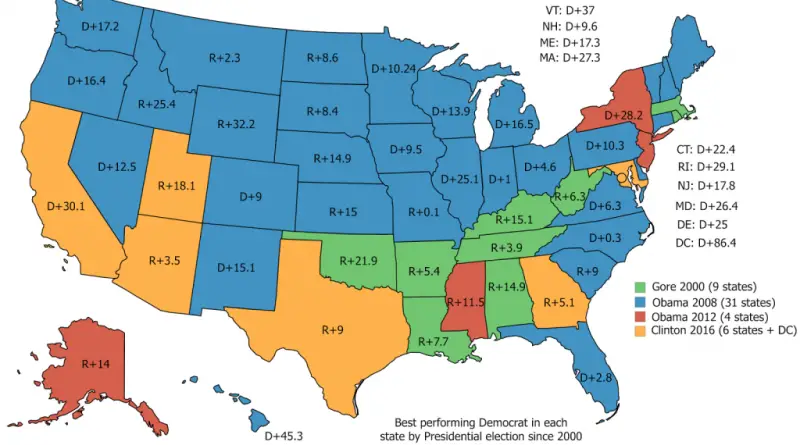
Best performing Democrat in each U.S. state by Presidential election since 2000
Reddit user: friendsknowusername
Read MoreResults of 2017 UK General Election
Full Results of 2017 UK Election:– Conservatives (right-wing, pro-hard Brexit): 318 seats (42.4% vote share)– Labour (left-wing, pro-soft Brexit): 261
Read MoreResults of 2017 UK General Election
Full Results of 2017 UK Election:– Conservatives (right-wing, pro-hard Brexit): 318 seats (42.4% vote share)– Labour (left-wing, pro-soft Brexit): 261
Read MoreU.S. states governors and senators by party affiliation from 1775 to 2017
U.S. States governors by party affiliation (1775 – 2017) U.S. States senators by party affiliation (1775 – 2017)
Read More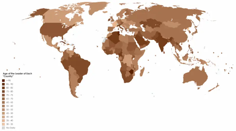
Age of the Leader of Each Country
Beyond physical stature, various factors, including education, experience, skills, and personality, are pivotal for career advancement in politics. Nonetheless, it’s
Read MoreMap of All International Airports in the U.S.
Reddit user: XxX_datboi69_XxX
Read More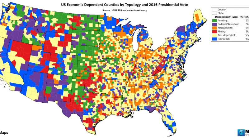
US economic dependent counties by typology and 2016 presidential vote
Via www.metricmaps.org/2017/06/02/us-economic-dependent-counties-by-typology-and-2016-presidential-vote
Read MoreUK election 2017: Which is the top searched political issue in your area?
The map shows normalized search interest in political issues by constituency, based on Google searches over the last 6 months.
Read More