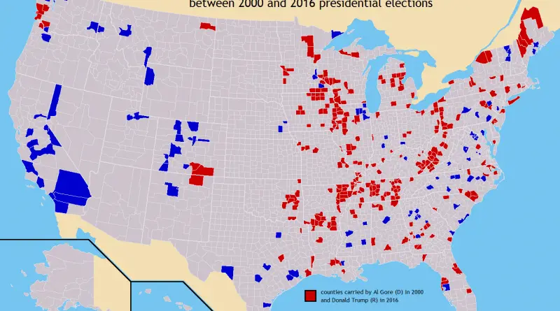
U.S. counties in which party of top vote-getter changed between 2000 & 2016 presidential elections
Related posts: – U.S. Presidential Election 2016 (Cartogram) – How America voted in every election (1824 – 2016) – The
Read MorePolitical Maps show governmental and administrative borders of countries, provinces, states, and counties, the location of major cities, and other political units.
Related posts: – U.S. Presidential Election 2016 (Cartogram) – How America voted in every election (1824 – 2016) – The
Read More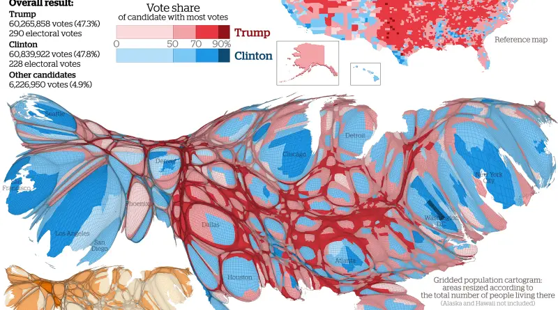
Results mapped at county level showing the candidate with the largest vote share in each area. Via viewsoftheworld.net Related posts:
Read More
The Polity IV score classifies the type of political regime for each country on a range from -10 (full autocracy)
Read More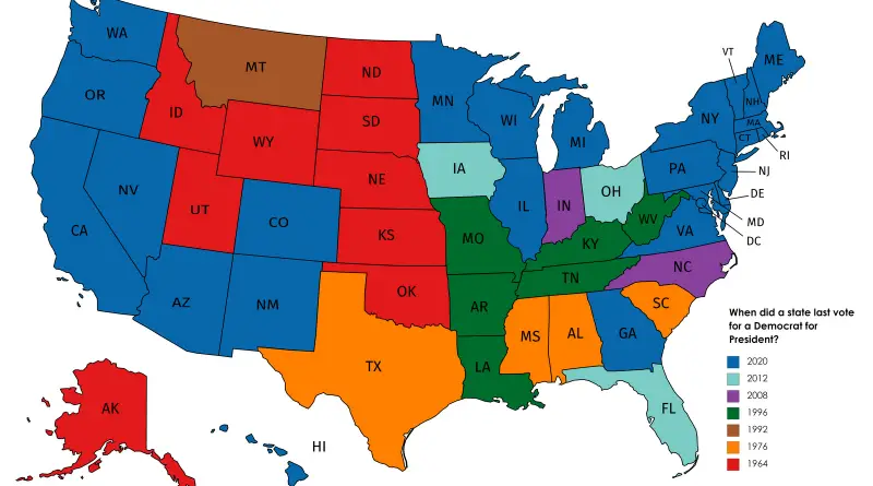
There have been 46 presidencies (including the contemporary one, Joe Biden, whose term began in 2021), and 45 different people have worked as president. Grover Cleveland was selected to 2 nonconsecutive terms, and as such, is regarded the 22nd and 24th president of the U.S.
While some U.S. states consistently have Democrat or Republican victories, other swings between the two parties. Here the U.S. presidential voting history science in 1789.
Read MoreRelated posts: – If “Did Not Vote” was a candidate in 2016, it would have won by a landslide –
Read More
Related posts: – The America That Never Wanted Hillary To Be President – Red Shift: Change in Democratic vote share
Read More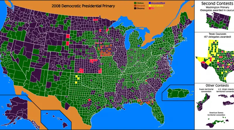
This is a map of counties that Hillary Clinton lost in both the 2008 and 2016 primaries. Hillary carried all
Read MoreRelated posts: – Red Shift: Change in Democratic vote share in presidential election (2012 – 2016) – Where each candidate
Read MoreRelated posts: – Where each candidate outperformed election forecasts – U.S. Presidential Election (2016) – How the presidential election of
Read MoreSource: fivethirtyeight.com, Google.com Via metrocosm.com Related posts: – U.S. Presidential Election (2016) – How the presidential election of 2016 would
Read More