Faithland – Mapping Religion Across America
Explore the religious landscape of the U.S. from 1890 to 2010 through maps I created using ARDA data. See how religion has shaped different areas over time.
Read More
Explore the religious landscape of the U.S. from 1890 to 2010 through maps I created using ARDA data. See how religion has shaped different areas over time.
Read More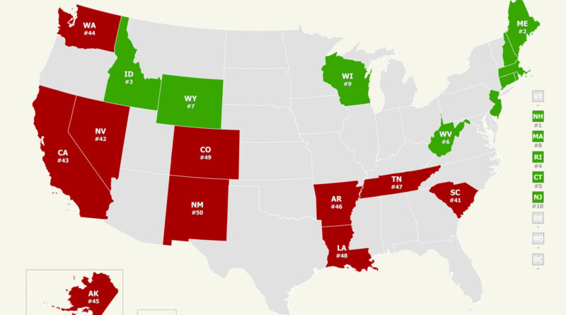
How safe is your state? Our analysis of the 2025 U.S. News & World Report public safety rankings uncovers unexpected trends across America. Through interactive maps, we discover why New England tops the safest states and some others struggle with ongoing problems.
Read More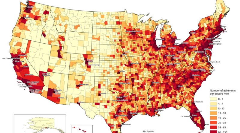
Based on ARDA’s 2020 U.S. Religion Census, about 161 million Americans are counted as religious adherents. This map shows where they’re most concentrated by land area, and an animation traces changes since 1890.
Read More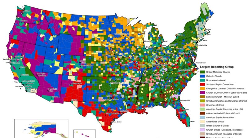
A look at the runner-up religious affiliations in each U.S. county, from Black Protestant churches in the South to Catholic and non-denominational growth in the West and cities, based on official census data.
Read More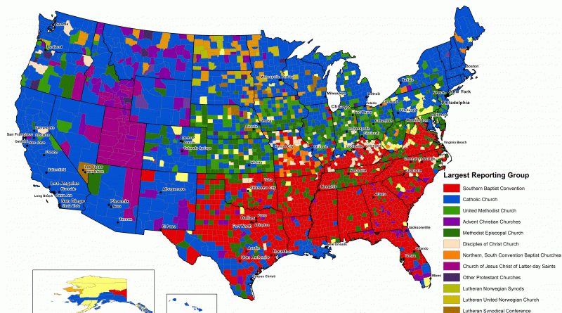
Group with the largest number of adherents by U.S. county (1906 – 1910) The “Other” category includes religious groups with
Read More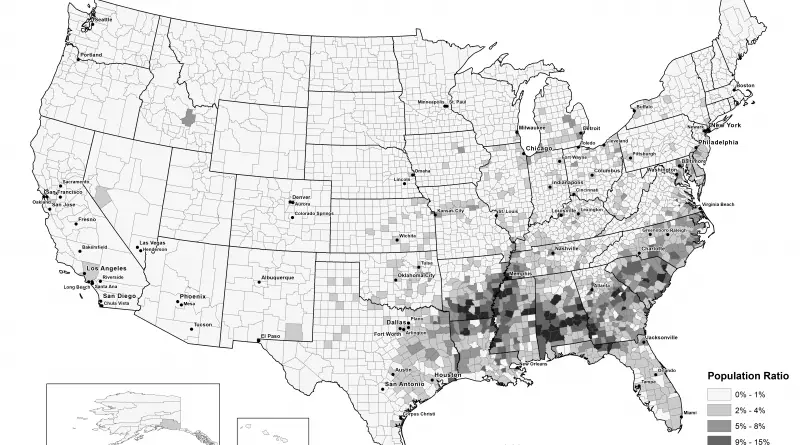
Most Black Protestant counties in America (2010): 1. Bullock County, Alabama – 31.6% 2. Ouachita County, Arkansas – 31.3% 3.
Read MoreEvangelical protestant population
Read More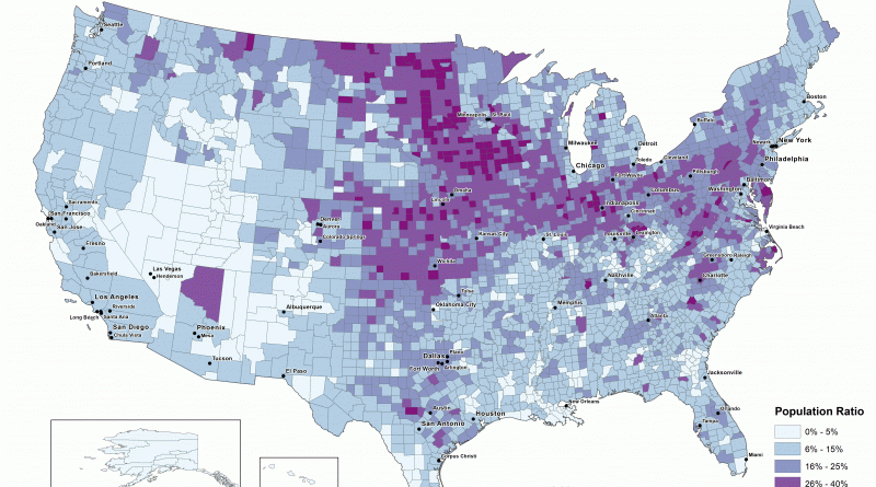
Mainline protestant population, 1936 – 2010 Mainline Protestant population, 2010 Most Mainline Protestant counties in America (2010): 1. Burke County,
Read More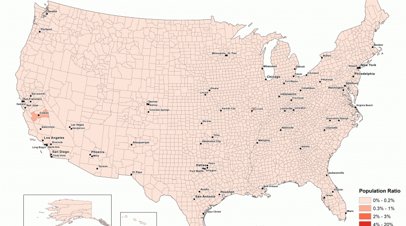
Orthodox Christians as a Percentage of all Residents, 1952 – 2010 Orthodox Christians as a Percentage of all Residents, 2010
Read More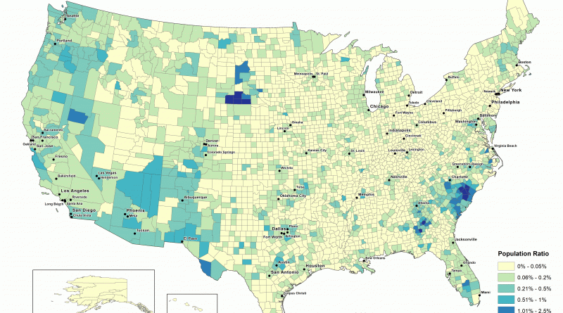
Population penetration, Baha’i groups in the United States (1980 -2010) youtube Population penetration, Baha’i groups in the United States (2010)
Read More