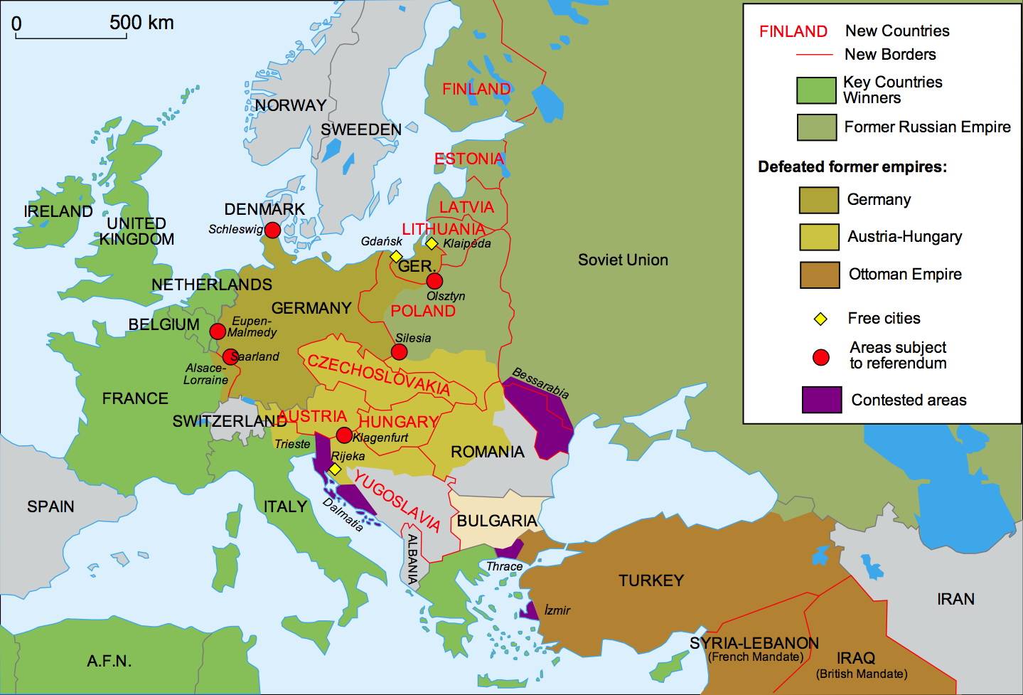
WWI involved thirty-two countries from 1914 to 1919. It changed the world map and reshaped various boundaries in Europe.
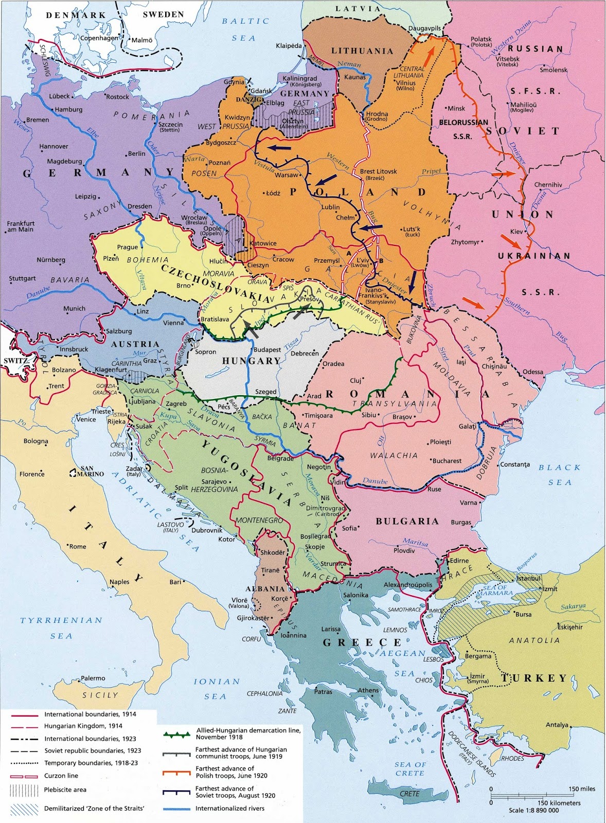
Central-Eastern Europe after World War I
Austria-Hungary was separated into many nations: Austria, Hungary, Czechoslovakia, Yugoslavia. The borders of Romania were extended based on ethnic reflections to include as many Romanians as possible inside its boundaries.
Poland was recreated from parts of Germany, Austria-Hungary, and the Russian Empire. The Polish corridor was provided to grant Poland access to the Baltic Sea. As a result, the German province of East Prussia was divided from the rest of the country.
Three Baltic states Lithuania, Latvia, Estonia, Finland, were created from part of the Russian Empire as well.