In the late 17th century, the mapping of France’s borders was a complex and significant endeavor due to various political, military, and territorial considerations.
The late 17th century was marked by a series of treaties and agreements that sought to define and establish the borders of France with its neighboring countries. Notable examples include the Treaty of Westphalia (1648), the Treaty of the Pyrenees (1659), and the Treaty of Nijmegen (1678-1679). These treaties aimed to resolve conflicts and delineate territorial boundaries, often through diplomatic negotiations.
The reign of Louis XIV (1643-1715) saw ambitious territorial expansion and a desire to consolidate and secure France’s borders. This led to the need for accurate and detailed maps to facilitate the administration and governance of newly acquired territories. Louis XIV’s engineers and cartographers played a key role in mapping these regions.
The late 17th century saw significant advancements in cartographic techniques and tools. Surveyors and cartographers used instruments like the theodolite and plane table to create more precise and detailed maps. Additionally, the use of triangulation and accurate measurements improved the accuracy of border mapping.
Louis XIV initiated several royal mapping projects to create detailed maps of various regions of France. The “Carte de Cassini,” for example, was a comprehensive topographic survey of France conducted by the Cassini family of astronomers and cartographers in the 18th century. While the project started in the 18th century, its roots can be traced back to the late 17th century.
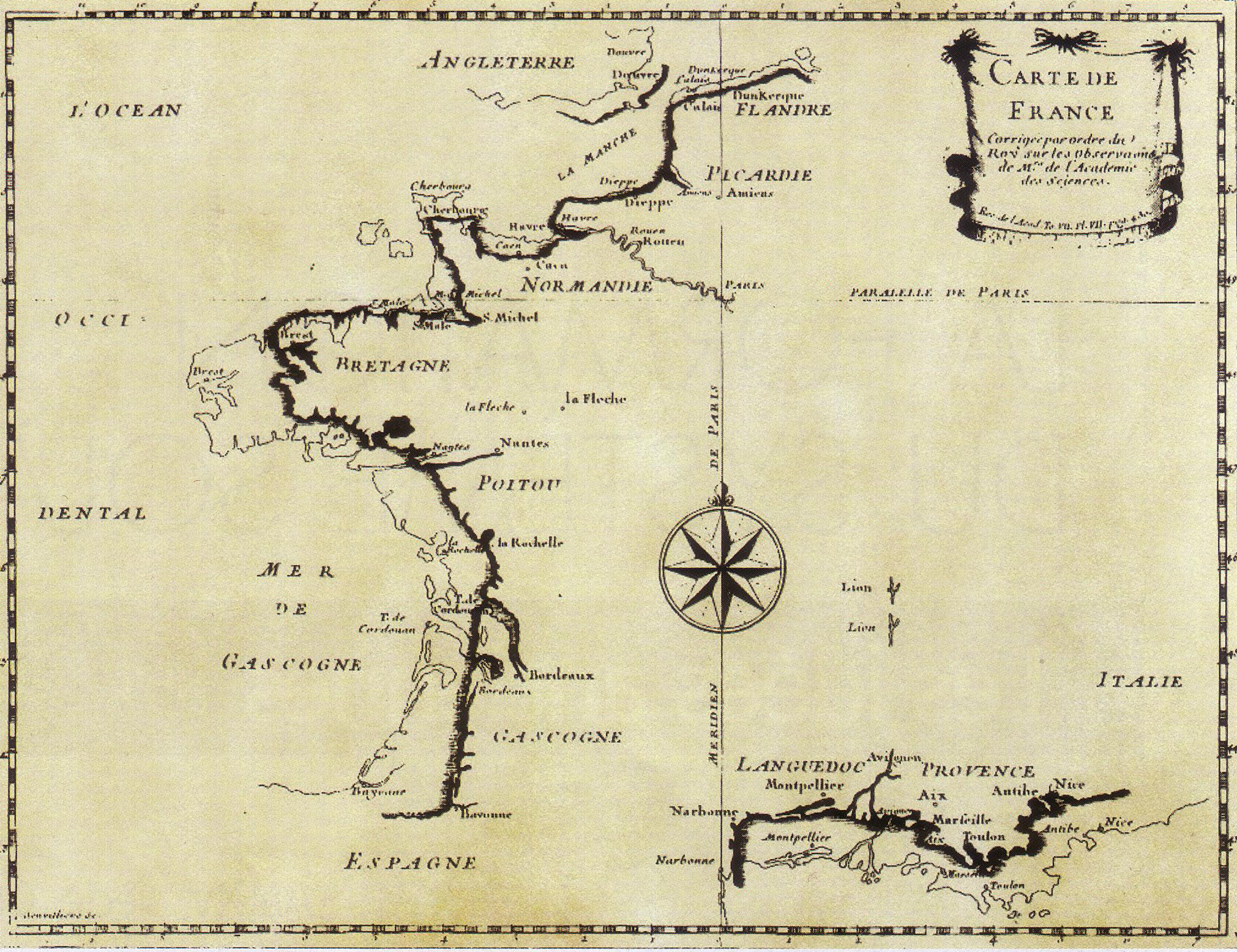
Below is the map of France “corrected on the order of the King, according to the observations of the Master of the Academy of Sciences”.
This map shows the difference between using single latitude observations combined with ships’ logs versus triangulation.
Triangulation spearheaded by the French dynasty of royal cartographers (the Cassini family) was basically the same mathematical technique being used by surveyors today, just with lasers and satellites as aides now.
To learn more about the history of France, have a look at the following books: