Germany has over 83 million people, the biggest economy in the EU, and a well-earned global reputation for engineering, punctuality, and very strong opinions about beer. Most people outside the country think of it as one thing. Germans themselves would disagree — loudly, and by state. People from Bavaria will let you know within minutes that they are specifically from Bavaria, not just “Germany.” People from Hamburg look down at Frankfurt. Almost everyone, at some point, makes fun of Saxony. Regional identity here is not subtle, and the internet has been documenting it for years in the form of stereotype maps. These three are some of the best.
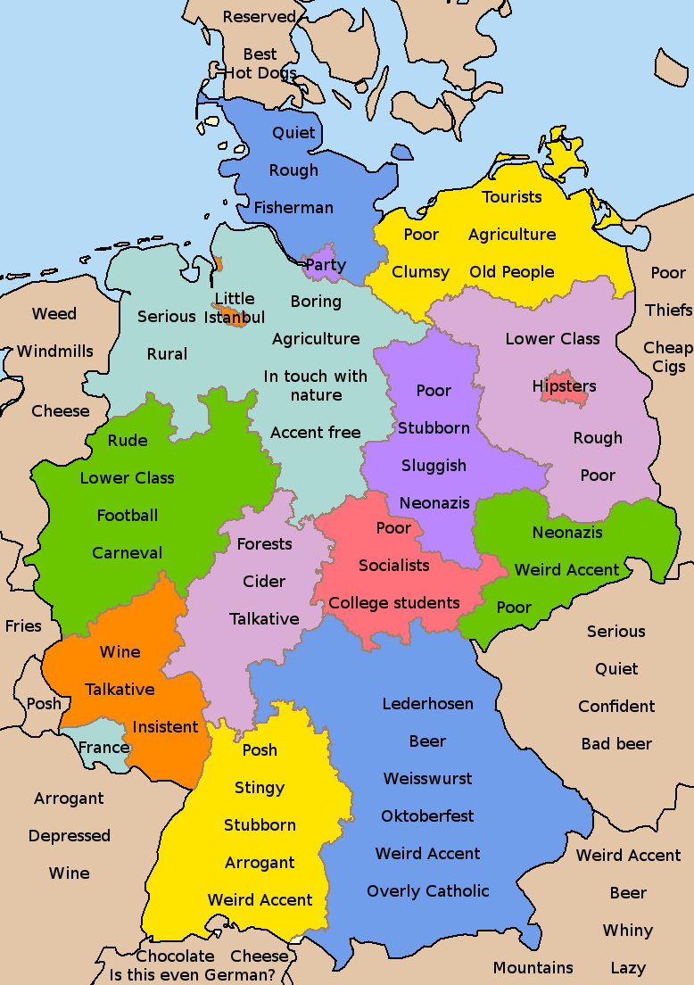
This one takes a relatively light approach. Each state gets a word or two, and most of it reads like the kind of thing you’d say about a coworker you mildly dislike rather than someone you genuinely have a problem with. Bavaria gets the full tourist-brochure treatment — “Beer,” “Lederhosen,” “Oktoberfest,” “Overly Catholic” — and honestly it’s hard to argue. More interesting are the edges of the map. France is labeled “Arrogant, Depressed, Wine.” Austria gets “Confident, Bad beer, Lazy.” The far northeast corner near Poland earns “Poor, Thieves, Cheap Cigs,” which says something real about how that border region is perceived — a legacy of reunification that still hasn’t fully closed the economic gap between east and west. Baden-Württemberg in the southwest is summed up as “Posh, Stingy, Stubborn, Arrogant,” which any Swabian will tell you is completely unfair, probably while calculating exactly how to split the restaurant bill.
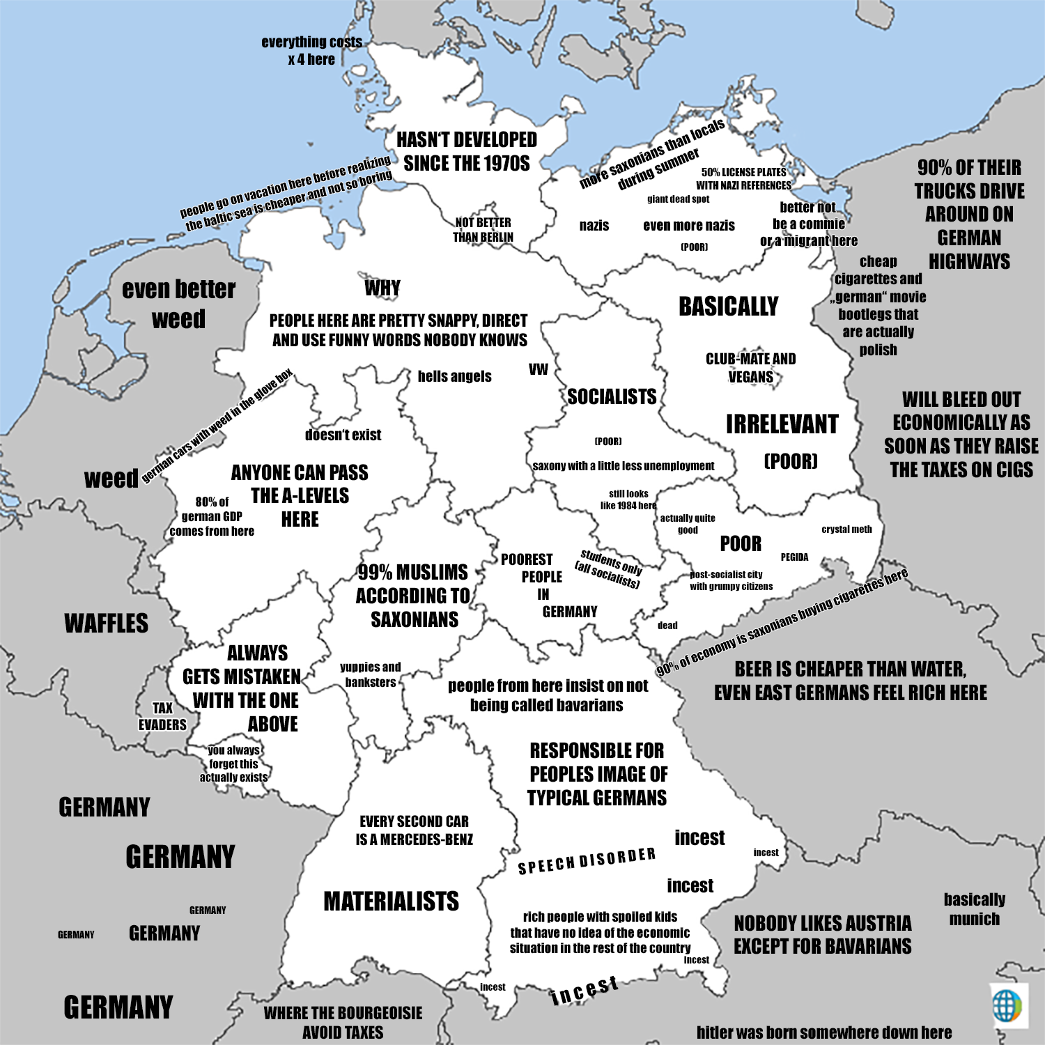
This one is less interested in being polite. The whole map runs in black and white, and the labels get considerably more specific. Saxony — always a target — earns “Poorest people in Germany,” “PEGIDA,” “Crystal meth,” and “still looks like 1984 here” all at once, which is a lot to carry. Bavaria pivots from its cheerful beer-festival reputation to “Responsible for peoples image of typical Germans,” “Materialists,” and “Where the bourgeoisie avoid taxes,” with the word “incest” scattered repeatedly across the Alpine south — a long-running internet joke about rural communities that the internet refuses to retire. The most quietly cutting label might be the one for Berlin’s fashionable neighborhoods: “Club-Mate and Vegans.” Anyone who has been to Prenzlauer Berg on a Sunday will understand immediately.
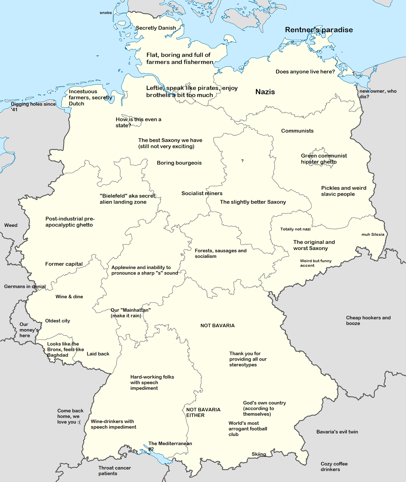
This version goes quieter and gets sharper. Where the previous maps lean on economic or political labels, this one is more interested in cultural absurdity. Hamburg “speaks like pirates, enjoys brothels a bit too much.” Frankfurt, with its cluster of glass towers that genuinely does look like a miniature Manhattan, is called “Our Mainhattan.” The area around Bielefeld is labeled “secret alien landing zone” — a reference to a long-running German conspiracy joke that the city of Bielefeld simply does not exist, which started as an internet meme in 1994 and somehow never died. Bavaria earns arguably the most accurate label of all three maps: “Thank you for providing all our stereotypes.” The regions just north of it — Franconia, which considers itself distinctly not Bavarian — are marked “NOT BAVARIA” and “NOT BAVARIA EITHER,” which captures that particular regional frustration perfectly. Austria, just across the southern border, gets “Bavaria’s evil twin.”
These maps don’t show roads or elevation or population density. What they do show is something harder to put on a standard map — the accumulated opinions, jokes, and low-grade regional resentments that shape how people actually think about the places they live in and the places their neighbors live in. Germany may be one country with one government and one passport, but looked at through the lens of these maps, it’s really 16 different places with 16 different sets of complaints about each other. The east-west divide runs through all three — sometimes as economics, sometimes as politics, sometimes just as a vague sense that things are different over there. Which they are. That’s the thing about stereotype maps: they’re not accurate, but they’re rarely entirely wrong either.