The German Empire was established in 1871 when the German states, except for Austria, united the North German Confederation.
After 1850, Germany’s states had quickly become industrialized. In 1913, Germany had a population of 68 million people. A heavily rural collection of states in 1815, the now united Germany became predominantly urban.
Throughout its 47 years of being, the German Empire was an industrial, technological, and scientific colossus, getting more Nobel Prizes in science than any other nation.
By 1900, Germany was the most exceptional economy in Europe, exceeding the United Kingdom and the second-largest in the world, following only the U.S., and became the 3rd-largest colonial Empire at the moment, after the British and French Empires.
Germany has become a powerful country, blowing fast-developing railroads, the world’s most powerful army, and a fast-developing manufacturing base. In less than a decade, its german fleet became second only to Britain’s Royal Navy.
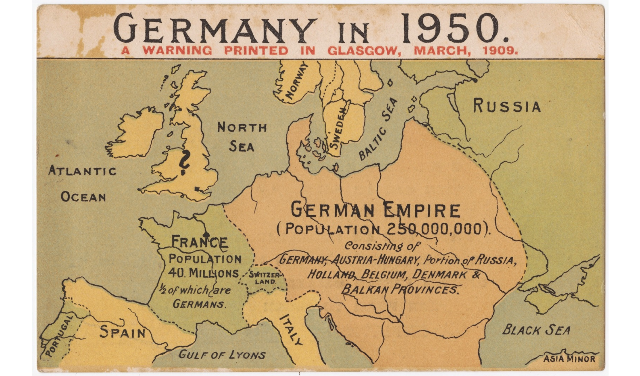
Therefore, many countries saw Germany as a threat. During the existence of the German Empire, a lot of maps appeared in many countries of the world, illustrating the future of the world in which Germany will be a superpower.
Germany in 1950: A warning printed in Glasgow, March 1909
The map was last published in March 1938 to warn European countries of the potential threat from Germany. This geographical map was printed repeatedly in 1909, 1918 and 1938.
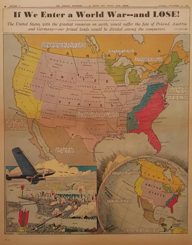
If We Enter a World War – and Lose! (1937)
Before the start of WWII, the assumption was that England and Germany would make a deal and attack the U.S. from Canada. The map below was printed in many Hearst newspapers.
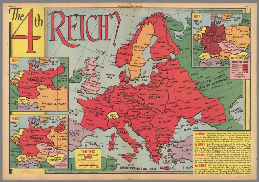
The 4th Reich? (1947)
The boundaries are still to be determined with four of the Allied countries controlling German lands and trying to form an agreement concerning the country’s future organization. The map was published in Sunday News, March 9, 1947.
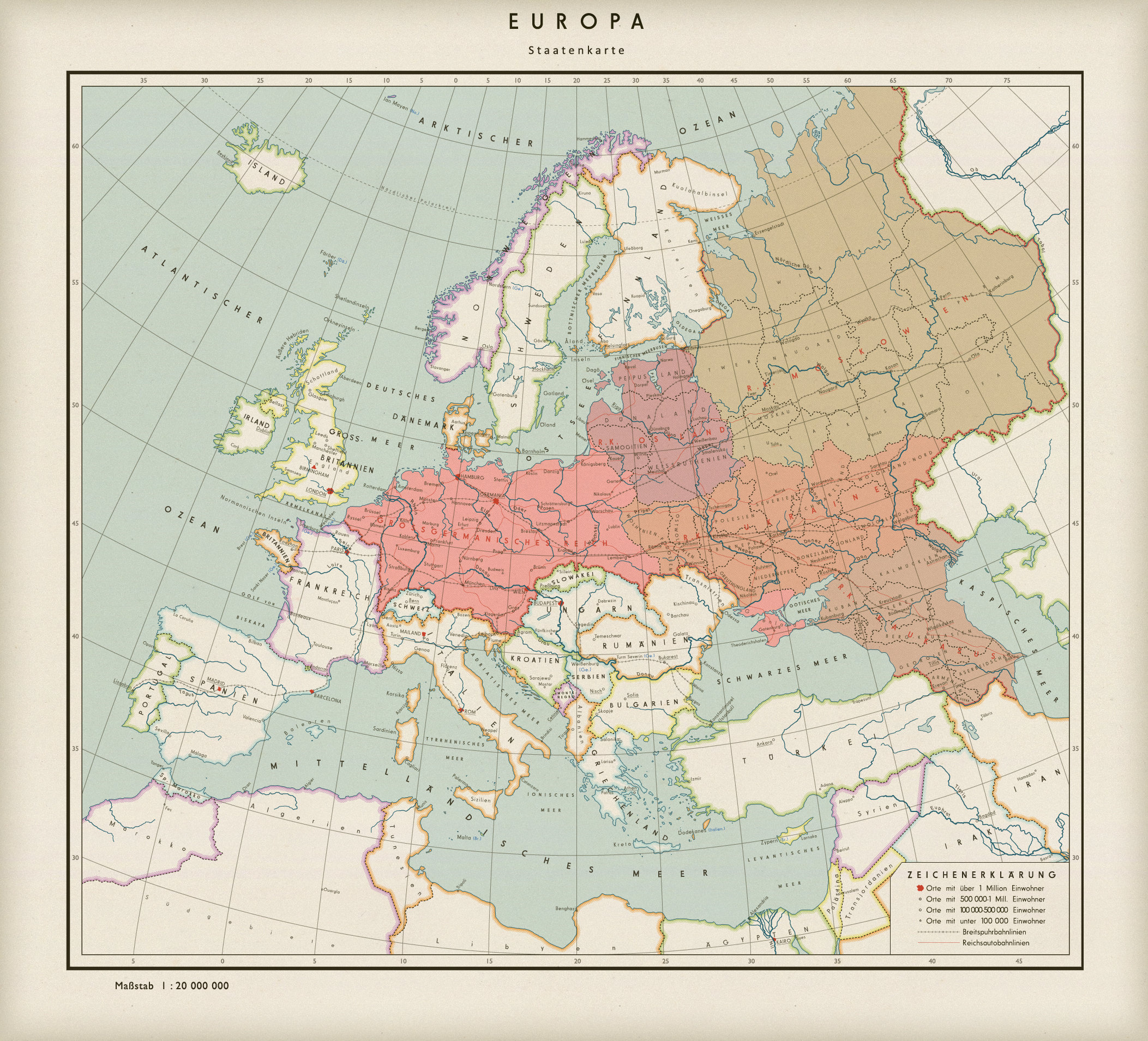
Modern views of what the world might have looked like if Germany had won the war
Below is a modern map of what Europe might have looked like if the Nazis had won the Second World War.
The red lines show the Autobahns that were built to connect this vast empire. The black rail like lines shows the broad-gauged railroad (three meters /9.8 ft/ wide, twice as broad as railroads are now) that were to be built as Germany’s version of shipping routes on the sea. What’s the point of having the largest empire in the world if you don’t also have the giant trains, right?
The cities (or rather, fortresses) of Nordstern (Trondheim) in Norway, Westhafen (Le Havre), Scherburg (Cherbourg), Brest and Sankt Nazer (Sainte-Nazaire) on the French Atlantic coast and Weißenburg (Belgrade) in Serbia were turned over to the Germans to guarantee the safety of the Reich.
The final peace treaty with France saw approximately all the territory that once belonged to the Holy Roman Empire be annexed by Germany. At the same time, Brittany was made an “independent” state like the pro-Nazi Slovak Republic. Italy got Savoy, Nice (the entire department, not just the old county) the Alps in between them, Corsica and Tunisia.


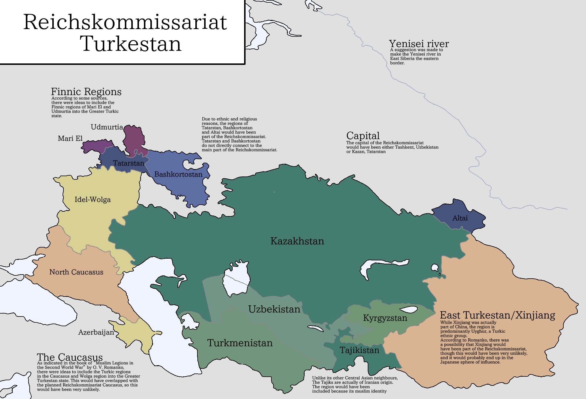
Map of the planned Reichskommissariat Turkestan