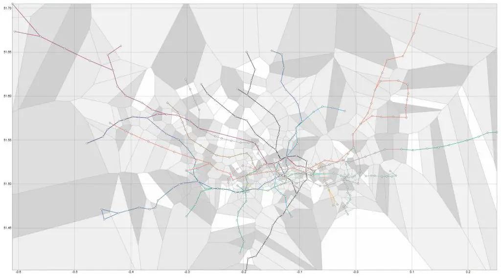
London Tube Map with Voronoi, showing closest station for every location in the city
Source: bl.ocks.org
Related posts:
– Key bus routes in central London (with top tourist attractions)
– London Traffic Counts Map
– Mapping London’s reach
– London’s Tube Heartbeat
– Visualizing transport for London accidents data
– How central London would look if the Tube map was geographically correct


