During the last three decades, China has achieved fast economic growth and tremendous industrialization, supported by urbanization.
Because of urbanization, by 2030, Chinese cities will be home to over 1 billion people–or up to 70 percent of the population.
China’s urban planning philosophies and approaches have experienced many transitions because of governance and economic structure shifts throughout the country’s extensive history. The establishment of the People’s Republic of China in 1949 denotes the start of three recent historical phases of urban planning that express a divergence from traditional Chinese urban planning morphologies, broadly categorized as a socialist, hybrid, and global cities.
Traditional Cities were planned according to the economies and governance of their time.
Socialist City planning efforts (1950–1980) focused on raising the percentage of blue-collar workers, building affordable housing, urban communes, work unit, Soviet-styled broad streets, and extensive squares.
Hybrid City planning (1860–Present) combines western planning and design principles linked with traditional Chinese architectural principles.
Global City planning (1990–Present) aimed to promote the strategic economic growth of an area for global economic participation as a dominant node in the globalized market. Such cities are characterized by densely populated metropolitan areas, central business districts, commercial and industrial zones, vast public transportation systems, and internationally networked airports.
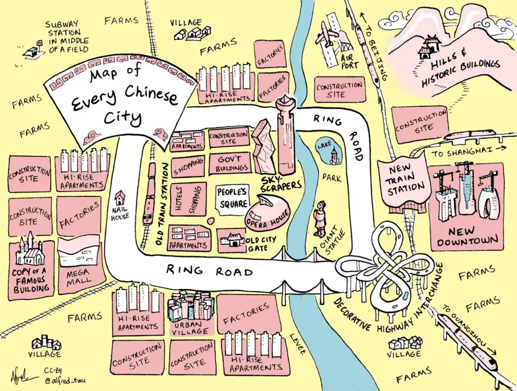
Inspired by Itchy Feet’s maps of Every American City and Every European City, Alfred Twu created a stereotypical map of Every Chinese City. On this map, you can find some elements of the different phases of urban planning in China.

 rated fast-food chains across the United States")


