Deadly Swiss Avalanches
Time lapse of fatal avalanches in Switzerland (1995 – 2016) The geographical distribution of fatal avalanches by the activity or
Read MoreTime lapse of fatal avalanches in Switzerland (1995 – 2016) The geographical distribution of fatal avalanches by the activity or
Read MoreThis map shows where England’s 10% most (red) and least (blue) deprived areas are. It is based on the 2015
Read MoreThe Eshhad Map is the visual representation of all data that Eshhad makes public from its database. The map allows
Read MoreThe Energy Trilemma Index ranks countries in terms of their likely ability to provide sustainable energy policies through the 3
Read MoreThe Top 50 Billionaires by Industry 1. Google Larry Page / Sergey Brin – $75.5 billionGoogle was founded by Larry
Read More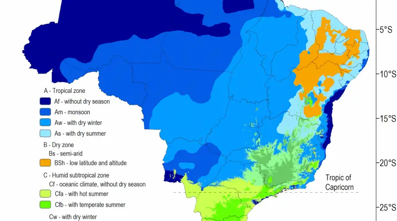
Related post:– Find cities with a similar climate
Read MoreApproval of the US, % GIVEN the dozens of times the United States has sent troops into Latin America, you
Read More