Days per Year of Average Day Land Surface Temperature Exceeding 80 F by US County (2003 – 2008)
Days per year of the average day land surface temperature exceeding 80 Fahrenheit (27°C) by сounty. Texas and Arizona have
Read More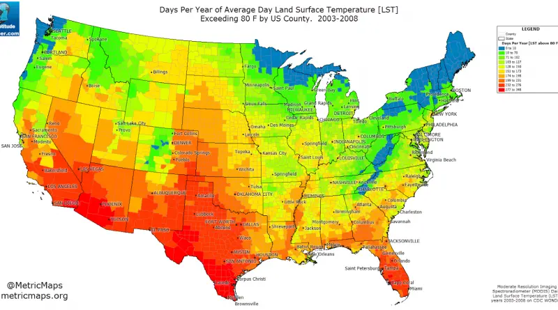
Days per year of the average day land surface temperature exceeding 80 Fahrenheit (27°C) by сounty. Texas and Arizona have
Read MoreThis map shows how long one would expect to travel to any point in Europe starting in London, using only
Read MoreBolivia covering approximately 1,098,581 (424,164 sq mi) and has population of around 12 million people. Population density: 10.4/km2 (26.9/sq mi).
Read MoreA digital total sediment thickness database for the world’s oceans and marginal seas is being compiled by the National Geophysical
Read More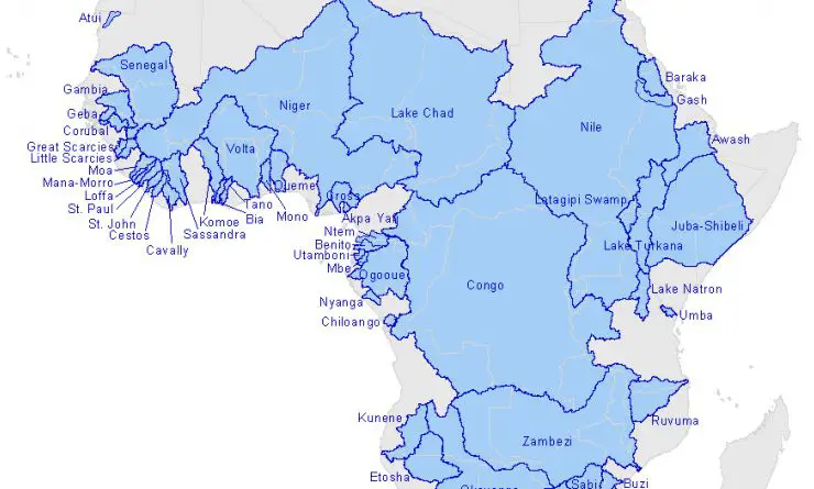
There are sixty-three transboundary river basins in Africa, covering 64 percent of the continent’s land area. Kongo is the largest
Read MoreToday the Vatican City State is just a new name for the Papal States. Italy never occupied the territory that
Read MoreFrom 1860 to 1870, the South of the U.S. demonstrated considerable homogeneity in land value gains across specific regions, such as urban areas and river counties. On average, the most significant increases occurred in the slave-dense areas such as the Mississippi Delta and Cotton Belt.
Read MoreChina (right) Meets Kazakhstan (left). China covering approximately 9,600,000 square kilometers (3,700,000 sq mi) and has population of around 1.404
Read MoreThe Russian-China boundary consists of 2 non-contiguous segments. The eastern, more extended border part is about 4,194 kilometers (2,607 mi) in length. The western border part is much shorter (less than 100 kilometers or 62 miles). Because of differences in population density, the border between the two countries is often visible from space.
Read MoreIn U.S. presidential elections, the national popular vote is the sum of all votes cast in every state and the
Read More