How split the United States into areas of similar population
The U.S. population is unevenly distributed across the country.
While some populous U.S. states hold historic centers of settlements and manufacturers like New York, Pennsylvania, and Ohio, the majority have now resided in the so-called Sunbelt, the southern and southwestern regions that have been demographically and economically growing since the 1960s (California, Texas, and Florida).
Nowadays the most of the biggest U.S. counties are concentrated among the top ten states in terms of population (California – 40m, Texas – 29m, Florida – 21m, New York – 20m, Pennsylvania – 13m, Illinois – 13m, Ohio – 12m, Georgia – 11m, North Carolina – 10m).
The maps below clearly explain the uneven distribution of the population of the United States.
Ten slices of the United States
Reddit user Curious kid created a great map of the United States population deciles by latitude and longitude. Each colored region on the map contains one-tenth (30.8 million) of the total U.S. population.

But we can also try to divide the United States territory into 50 regions of an equal population separated by lines of longitude.
Taking lines of longitude to divide the United States into 50 equal-population states

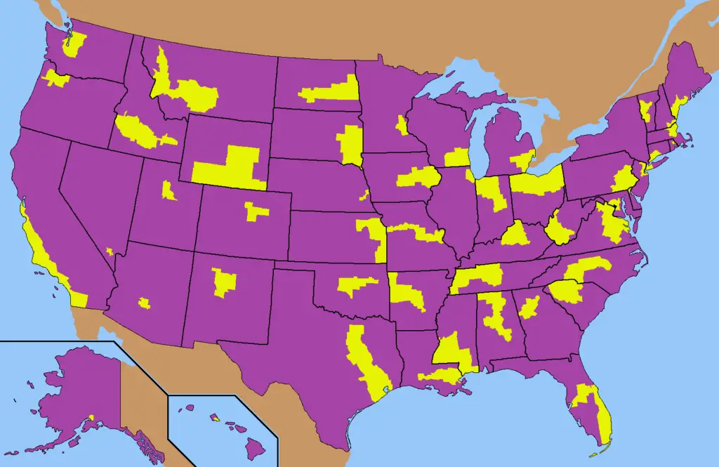
Each state split In half by population
Finally, let’s try to divide every American state in half by population.


")


longitudinal markings?