Canada is the second-largest country in the world, covering about 9.98 million km² (3.85 million sq mi), stretching from the Atlantic Ocean to the Pacific Ocean and deep into the Arctic. Despite its enormous size, Canada has a population of about 41 million people, and most Canadians live close to the U.S. border where the climate is milder.
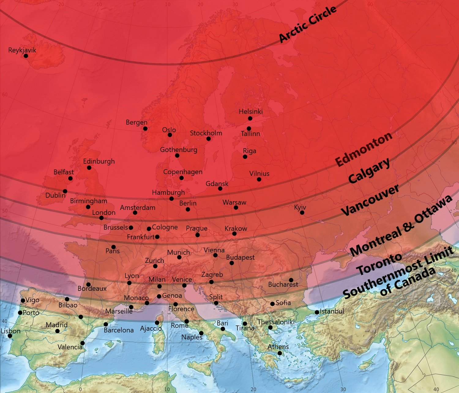
This creates a common misconception. When many people imagine Canada, they picture Arctic landscapes, frozen tundra and endless northern forests. But the country’s largest cities are located much farther south. The map by Reddit user Aijol10 compares the latitudes of Canada’s major cities with Europe and shows just how far south much of Canada’s population actually lives.
Vancouver, Canada’s western coastal city with a metro population of more than 2.6 million people, is located at about 49.3°N, almost the same latitude as Paris at 48.9°N. Calgary at 51.0°N is close to London at 51.5°N, while Edmonton at 53.5°N lines up with Hamburg at 53.6°N and Dublin at 53.3°N.
Further east, Toronto sits at about 43.7°N, almost matching Florence and Split. Montreal and Ottawa are around 45.5°N, close to Lyon and Venice. Even Canada’s southernmost point, Middle Island in Lake Erie at about 41.7°N, is almost exactly the latitude of Rome at 41.9°N.
The reason Canada feels colder than Europe at similar latitudes comes from geography. Much of Canada lacks the warming influence of the North Atlantic Drift that helps keep western Europe relatively mild. Large parts of the country also have a continental climate with colder winters and greater seasonal temperature changes.