Interactive swell map
VentuSky visualized the movement of waves in the world’s oceans and seas. Related post: – Wind, Rain and Temperature Interactive Maps
Read MoreVentuSky visualized the movement of waves in the world’s oceans and seas. Related post: – Wind, Rain and Temperature Interactive Maps
Read More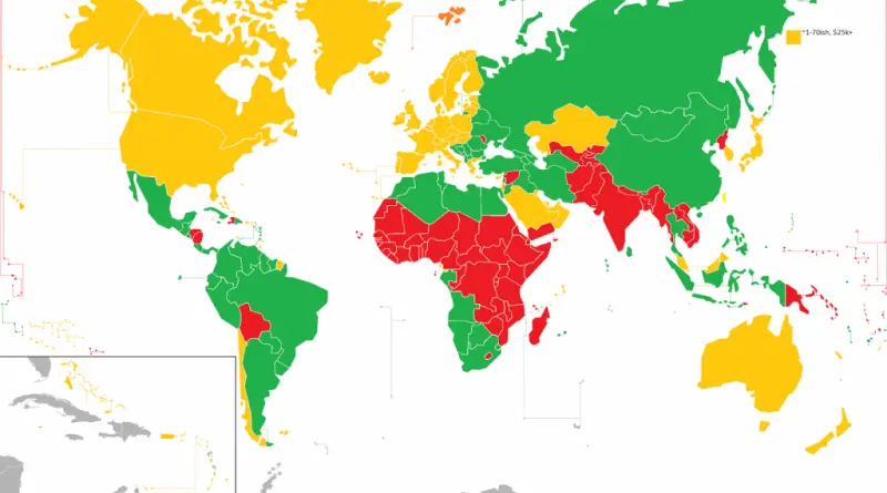
The new 1st, 2nd, and 3rd World according to Gross Domestic Product (GDP) per capita The new 1st, 2nd, and
Read More
Reddit user: famicon3 Related post: – The best and worst films of each country in Europe according to IMDB (2015)
Read MoreUK Snow Map uses crowd-sourced #uksnow tweets to draw an up-to-the-minute map of where it is currently snowing in the
Read MoreWhere are the tallest buildings in Vancouver? Where are the towers with podiums, or the walk-up apartment buildings, or the
Read MoreUnderstanding and promoting urban tree cover has never been more important Increasing a city’s tree canopy contributes to lowering urban
Read MoreRelated posts: – New York’s Subway Deserts – New York City boroughs journey to work-driving ca alone vs. walk/public transportation
Read MoreThe Atlas of ReUrbanism is a tool to understand, support, and transform American cities. Developed by the Preservation Green
Read More