Globalization Index 2016
Globalization is the process of international integration arising from the interchange of world views, products, ideas and other aspects of
Read MoreGlobalization is the process of international integration arising from the interchange of world views, products, ideas and other aspects of
Read More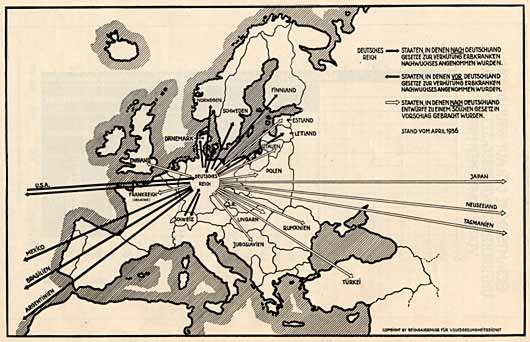
Eugenics, once seen as a path to social progress, led to forced sterilizations and racial discrimination. Explore how this dangerous idea influenced policies around the world.
Read More
Good Society Index (GSI) is operationally constructed using WHO data on infant mortality and life expectancy and World Value Survey
Read MoreTraffic violations in the city of Turin by location, type of vehicle, type of violation, by date, time of day
Read More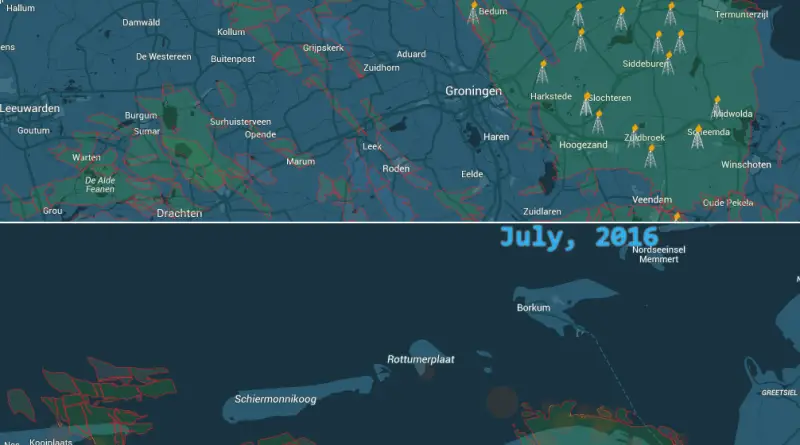
Groningen has the largest natural gas field in the Netherlands, and is prone to earthquakes. Shell and ExxonMobil gas drilling
Read MoreWeather is the condition of the atmosphere, defining the degree to which it is freezing or warm, dry or humid, still or stormy, clear or cloudy. On our planet, most weather aspects occur in the troposphere. Weather applies to everyday temperature, precipitation, air pressure, moisture, and other atmospheric statuses, whereas climate describes average atmospheric conditions over more extended periods.
Read MoreIn-State Tuition & Fees at Public Four-Year Insitutions
Read More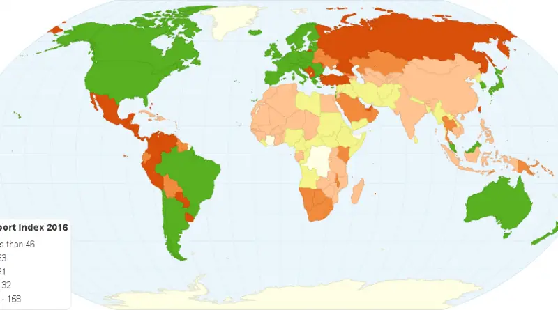
Passports of the world ranked by their total visa-free score. 1 Germany 1581 Sweden 158 2 Finland 1572 Switzerland 1572
Read MoreGlobal Terrorism Database has over 17.500 known terrorism attacks between 2006 and 2015 in Iraq, resulting in 52.000 deaths. Via
Read MoreVia cdc.gov Related posts: – Cause of death most disproportionately affecting each state
Read More