Political maps
Political Maps show governmental and administrative borders of countries, provinces, states, and counties, the location of major cities, and other political units.
Fragile State Index (2017)
Source: epatrono The Fragile States Index is an annual report published by the U.S. think tank, the Fund for Peace
Read More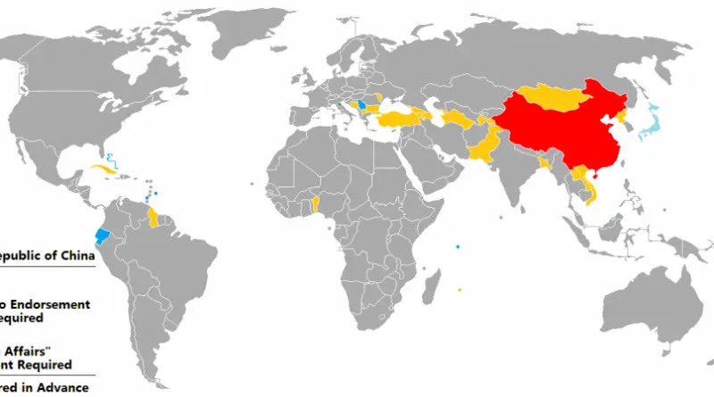
Visa Policy of China
Source: wikipedia.org
Read MoreThe approval rating of each governor
The highest is Republican Charlie Baker of Massachusetts at 75% and the lowest is Republican Chris Christie of New Jersey
Read More
Political Position of Governing Parties of Europe (1946 – 2017)
Notes: – Colour is based on the political position of the head of the government’s party, according to Wikipedia. –
Read MoreCountries where Head of State is of German ancestry
Reddit user: trinitronbx
Read More
A map of Canada’s first ever election (1867)
A little late for Canada 150, but here is a map of Canada’s first ever election – held between August
Read More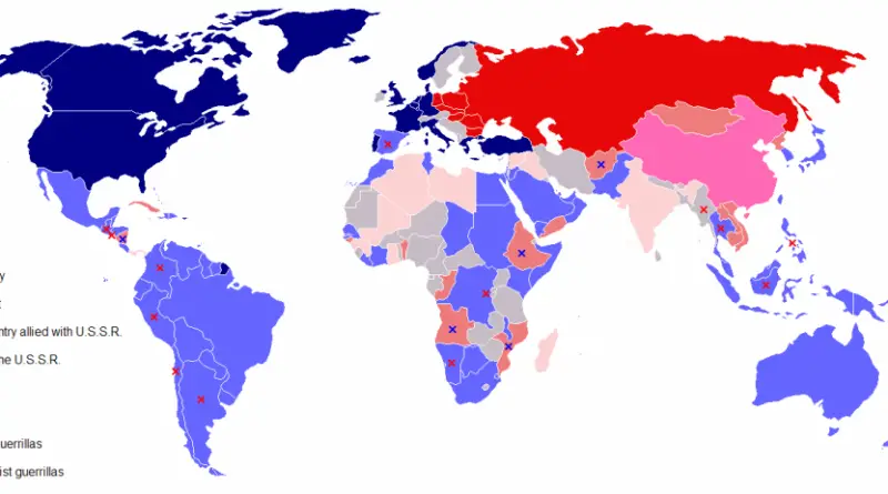
Map of the Cold War
The Cold War was a geopolitical and ideological struggle that emerged in the aftermath of WWII, lasting roughly from the late 1940s to the early 1990s. It primarily pitted the United States and its Western allies against the Soviet Union and the Eastern Bloc, marked by intense political, economic, and military rivalry.
Read MoreThe Colours of The Electorate
The standard electorate map tends to be the choropleth style. These maps will typically fill an entire constituency with the
Read More