Ever wondered what the United States map might look like if our major cities determined state boundaries? A fascinating new political map offers just such a perspective, reimagining the country’s landscape in a way that challenges our understanding of geography and electoral politics.
This intriguing United States map created by @StatisticUrban presents 48 hypothetical states, each centered around one of the nation’s largest urban areas. What makes this map unique is its use of a Voronoi partition–a mathematical concept that ensures every point within a new “state” is closer to its urban core than to any other major city.
The result is a United States map that looks strikingly different from the one we’re used to. Gone are the familiar shapes of Texas, California, and Florida. Instead, we see a patchwork of territories that radiate outward from major metropolitan hubs, creating a visually striking representation of urban influence.
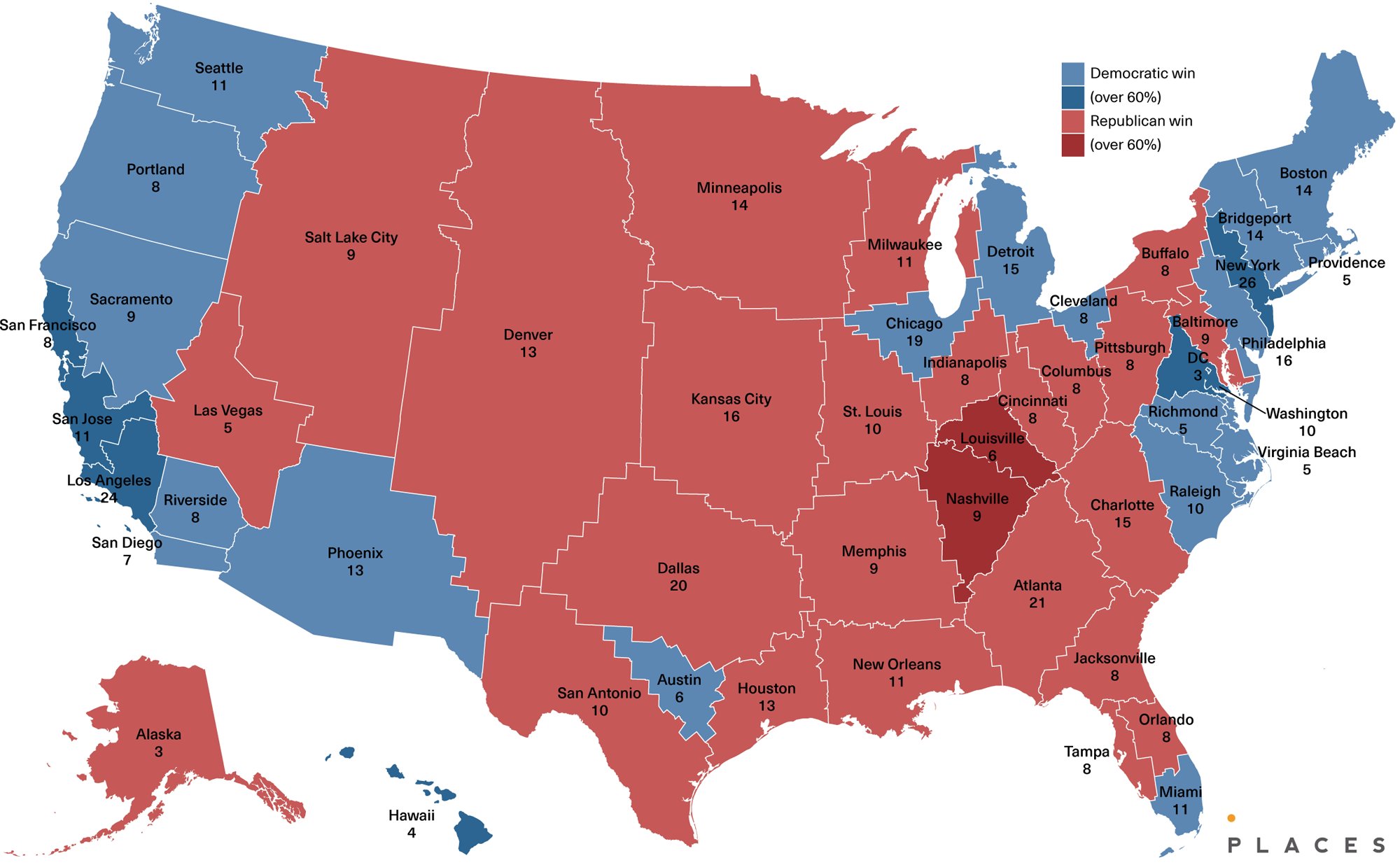
But this isn’t just an exercise in creative cartography. The map goes a step further by predicting the political leanings and Electoral College votes for each of these hypothetical states. Surprisingly, the outcome mirrors the close margins we’ve seen in recent elections. The map projects a razor-thin 270-268 victory for the Democrats in the Electoral College. When Alaska and Hawaii are factored in, the split becomes 26 Republican-leaning states to 24 Democratic-leaning states – a nation almost evenly divided.
One interesting detail that catches the eye is the map’s squiggly borders. These irregular boundaries aren’t just for show – they’re the result of keeping existing counties intact within the new state lines.
While this reimagined United States map is purely hypothetical, it offers valuable insights into the relationship between urban centers, population distribution, and political affiliations. It challenges us to think about how our current state boundaries influence election outcomes and whether an urban-centric approach might lead to different results.
For those interested in exploring more traditional United States maps, here are some excellent options available on Amazon: