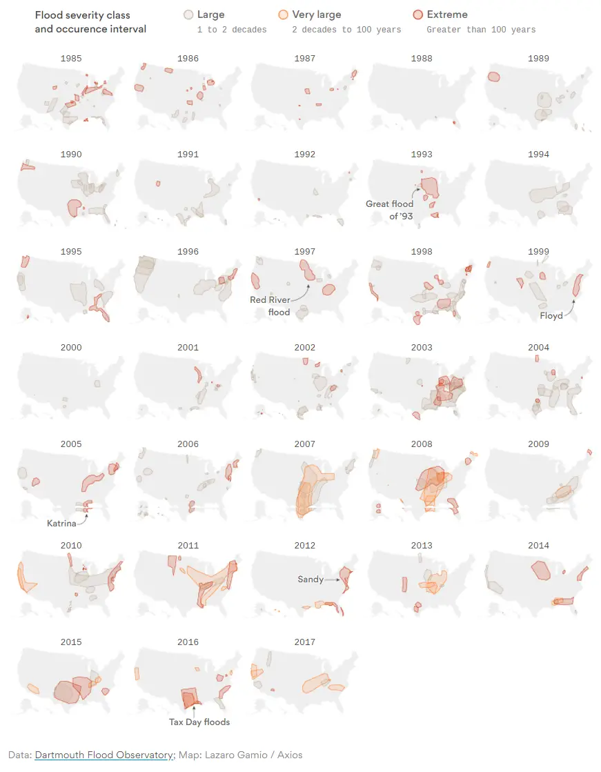
Climate scientists say extreme flooding events will become more common as the climate warms because storms will dump more rain and the sea levels will rise (according to NOAA, already 2.6 inches globally between 1993 and 2014). The map below created by axios.com shows major flooding events that have occurred in the United States since 1985.
US flood risk is basically a wash thanks to changing weather patterns
A University of Iowa study has found that the risk of flooding is changing in the U.S. and varies regionally. The threat of moderate flooding is increasing generally in the northern United States (red areas) and decreasing in the southern U.S. (blue areas), while some regions remain mostly unchanged (gray areas). The findings come from comparing river heights at 2,042 locations with NASA satellite information showing the amount of water in the ground. The study was published in the journal Geophysical Research Letters.


?")


