Greece has a long and storied history, with its borders and territories shifting dramatically over the centuries. These captivating maps provide a visual timeline of the country’s remarkable transformations.
In 1832, Greece was established as a sovereign kingdom, breaking free from the Ottoman Empire. As compensation, the new nation had to pay 40 million piastres to the Ottomans for the lost territory.
Following the Balkan Wars in 1913, Greece’s borders and population nearly doubled in size. The country gained control of Crete, Epirus, and Macedonia. This “New Greater Greece” is depicted in the 1920 map below, with the yellow areas showing Greece’s pre-1912 boundaries, the red denoting gains from the Balkan Wars, and the blue representing the 1920 borders.
After World War I, Greece attempted to further expand into Asia Minor, where a large Greek population resided. However, the Greco-Turkish War of 1919-1922 ended in defeat for Greece, leading to the mass exodus of Asia Minor Greeks.
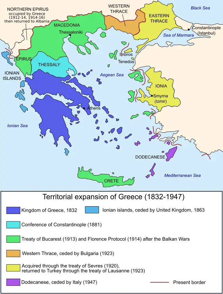
The map below shows Greece’s territorial expansion from 1832 to 1947, a period that saw the country grow significantly in size and influence.
These captivating cartographic representations provide a vivid window into the dynamic history of modern Greece. They illustrate the nation’s hard-fought journey towards independence and its ongoing territorial evolution.

")

")


da ricordare
troppa roba?