Martin Behaim wrapped up the Erdapfel in Nuremberg in 1492. No other globe from that era has survived. Where did Behaim get his information? Ptolemy’s ancient measurements formed the base. Marco Polo’s writings about Asia added detail. Portuguese ships sailing down Africa’s coast brought back new geographic data. The Americas weren’t on anyone’s map yet because Columbus was still months away from landing there.
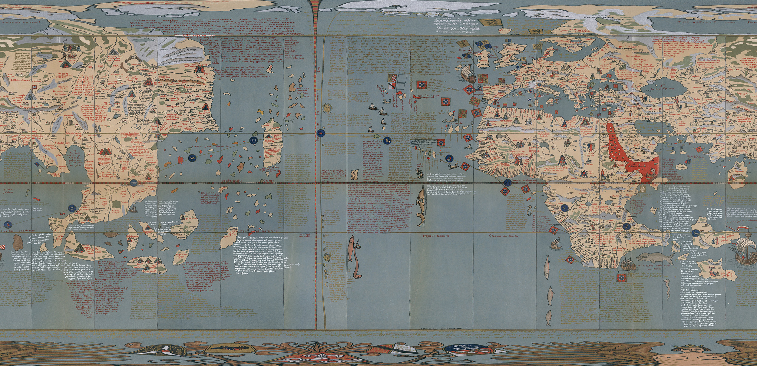
Georg Glockendon painted it by hand across twelve gores and two polar caps. The David Rumsey Map Collection has the map, which I animated using Map to Globe.
The Americas? Not there. Trace your finger west from Portugal across the Atlantic and the next land you hit is Japan (Europeans called it Cipangu then). There’s no Pacific as its own ocean. The Atlantic just continues into Asian waters.
The original globe still sits in Nuremberg. Most people study E.G. Ravenstein’s 1908 facsimile instead. Ravenstein compared the original with an 1847 copy to make his reproduction, which gives us the best version to work with today.
Behaim’s measurements put Earth at 29,000 kilometers (18,000 miles) around. The actual equator measures 40,075 km (24,901 mi). This globe shrinks the planet by 27%. That’s an 11,000 km (6,800 mi) mistake. To put it in perspective, New York to Tokyo is about the same distance.
That smaller Earth changed how Europeans thought about ocean crossings. The Atlantic looked manageable for ships in the late 1400s. Asia appeared to sit about where the Caribbean actually is. Running the numbers on food, water, and sailing time made westward trade routes look reasonable.
Columbus worked with even more optimistic numbers than these. Behaim’s globe shows us where European understanding of geography sat right before ships headed west and ran into continents nobody expected to find.
Ptolemy got the circumference wrong originally. Marco Polo’s travel times made Asia seem to extend further east. These mistakes didn’t just add together. They backed each other up until Europeans had built a complete picture of the world that looked logical while missing two continents and calculating the planet more than a quarter too small.
If you’re looking for a globe, here are some options on Amazon: