The Spread of Venezuelans Abroad
Tough economic hits and political pressures drove over 8 million Venezuelans to new homes abroad, detailed in this eye-opening map. Recent US-backed moves against Maduro might flip the script.
Read More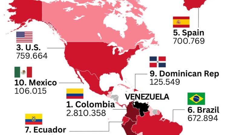
Tough economic hits and political pressures drove over 8 million Venezuelans to new homes abroad, detailed in this eye-opening map. Recent US-backed moves against Maduro might flip the script.
Read More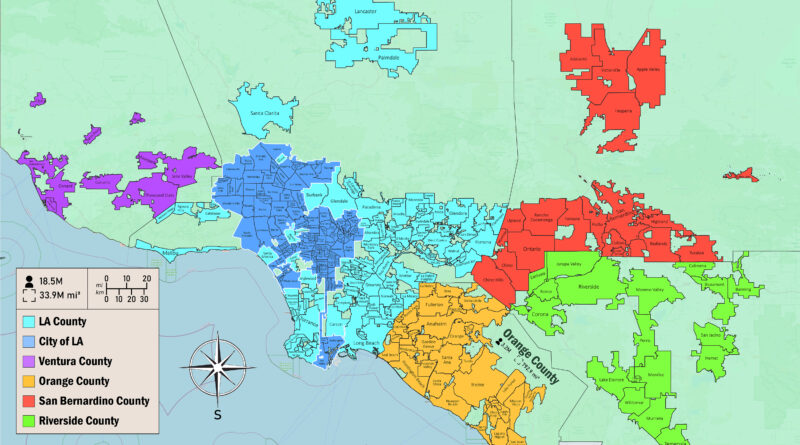
Greater Los Angeles holds 18.5 million people across seven counties with extremely different densities. Orange County packs 3,345 people per square mile while San Bernardino County has 109. LA County median homes cost over $800,000 versus under $600,000 in Riverside County, driving projections that LA County could lose 1.4 million residents by 2060.
Read More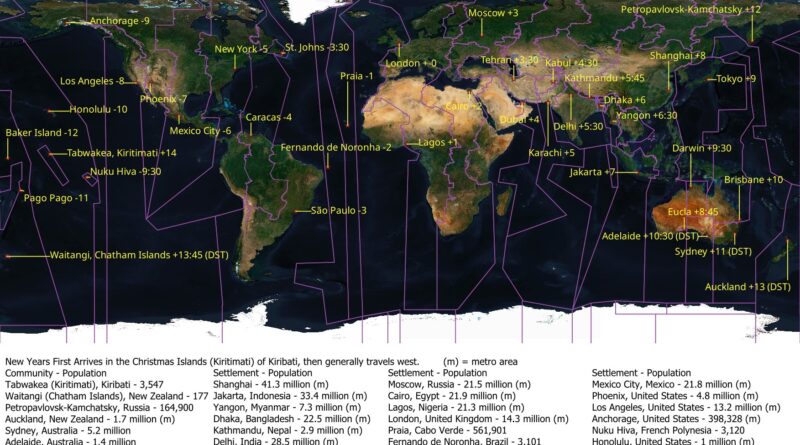
New Year’s begins on Kiritimati with just 3,547 in that zone, then moves west to reach everyone
Read More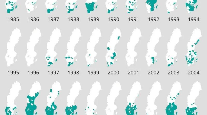
How has Sweden’s white Christmas changed over the past fifty years? This SMHI dataset maps snow presence across the country from 1975 to 2024, showing a geographic divide that’s become more pronounced over time.
Read More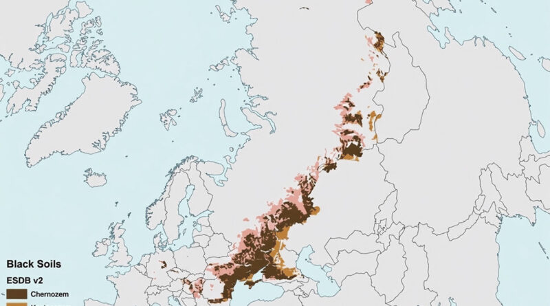
Ever wondered where the world’s richest soils are? This map shows the global distribution of chernozems (a type of black soil). And according to the map, just three countries hold most of these extraordinarily fertile lands.
Read More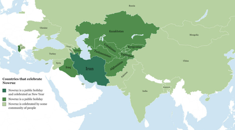
Around 300 million people don’t celebrate New Year on January 1st—they wait for March 20 or 21 when spring begins.
Read More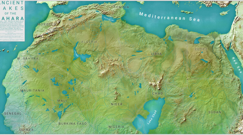
The Sahara wasn’t always sand and heat. Carl Churchill’s map reconstructs what North Africa looked like 8,000 years ago during the African Humid Period—a time when Lake Chad, Lake Darfur, Lake Ahmet, and The Chotts formed a network of waterways across grasslands. Ancient humans traveled these routes before climate shifts turned the region into desert.
Read More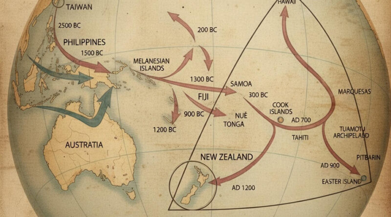
People who left Taiwan before 3000 BC eventually reached New Zealand by 1200 AD—a 4,000-year migration across scattered Pacific islands. This map traces the routes and dates of each leg of the journey, from the Philippines (2500 BC) through the Cook Islands (800 BC) to the final settlements in Hawaii, Easter Island, and New Zealand.
Read More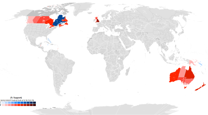
Recent polling from 15 Commonwealth realms shows huge differences in how people view having King Charles III as head of state. England leads at 76% monarchy support, with Tuvalu second at 73%. Quebec goes 70% for a republic, standing apart from other Canadian provinces. The Bahamas hits 65% republican sentiment, Jamaica 55%. Australia’s Capital Territory is the only part of that country preferring a republic at 59%. Caribbean nations cite colonial history as a major factor in their views.
Read More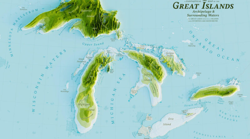
Five years ago, I made a stylized Great Islands map. Recently I found Stephen Kennedy’s version, and it got me thinking about what actually lives in these lakes. When you see them as islands, you remember they’re not just water—they’re ecosystems packed with life.
Read More