When Los Angeles Becomes a Bay
Jeffrey Linn mapped what Southern California looks like when 80 meters (260 ft) of seawater flood the LA Basin. Two versions show the transformation from basin to bay.
Read More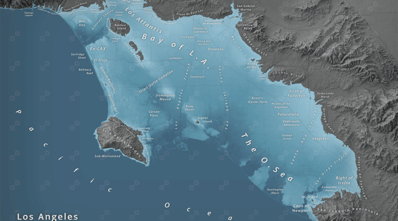
Jeffrey Linn mapped what Southern California looks like when 80 meters (260 ft) of seawater flood the LA Basin. Two versions show the transformation from basin to bay.
Read More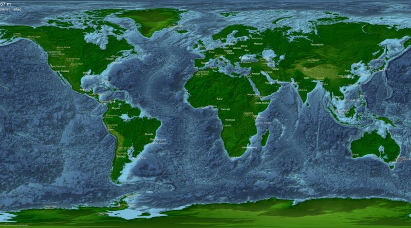
Earth’s seas are rising today, but the long-term future holds both floods and droughts on a planetary scale. See maps I created showing what our world would look like if all ice melted, if alien oceans were added, and when Earth eventually runs dry.
Read More
If all the ice on our planet were to melt, it would result in a substantial rise in the level of the world’s oceans. The estimated sea level rise would be approximately 66 meters (216 feet).
Read More
If all the ice covering Antarctica, Greenland, (Antarctica would make about 60 meters of sea-level rise, Greenland about 60 meters) and in mountain ice caps around the globe were to melt, sea level would rise about 70 meters (230 feet) and cover all seaside cities.
Read More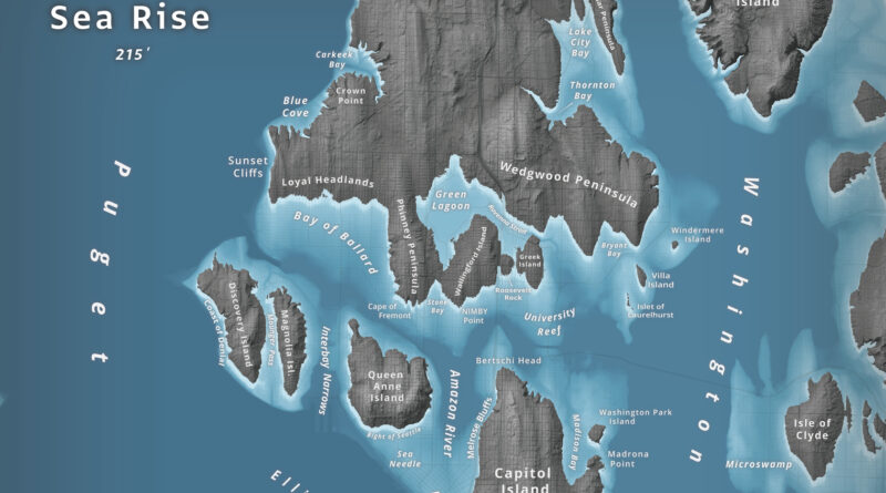
What happens to Seattle when 66 meters of water flood Puget Sound? Jeffrey Linn used LiDAR elevation data to map the city as an archipelago, where Capitol Hill becomes “Capitol Island” and the Space Needle turns into the “Sea Needle.” He created two versions with different cartographic styles.
Read More