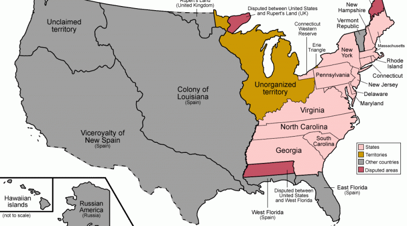
United States

Maps of the US

Historical MapsWars

Operation Barbarossa Superimposed onto a map of the U.S.

Operation Barbarossa was the invasion of the USSR by Nazi Germany and many of its Axis allies, starting on Sunday, 22 June 1941, during World War II. The military operation, codenamed after Frederick Barbarossa (“red beard”), a 12th-century Holy Roman emperor and German king, put into activity Nazi Germany’s ideological goal of occupying the western USSR to repopulate it with Germans.

Read More
Ethnic maps

Americans with Polish Ancestry Mapped

The story of Americans with Polish ancestry is one of resilience, hard work, and cultural contribution. Poles have been immigrating to the United States for centuries, shaping the nation’s landscape and contributing significantly to its development. Let’s delve into the history and current status of Polish migration to the United States.

Read More
Political maps

U.S. Presidential election 2016: dasymetric dot density

Most election maps mislead by shading entire counties red or blue, but what if we mapped every single vote exactly where people live? This dasymetric dot density map does just that—placing 130+ million dots based on urban, suburban, and rural population densities. The result? A clearer, more accurate picture of the 2016 election. See the real voting patterns emerge! 🔴🔵 Explore the map now.

Read More