Frequency of Lighting strikes
Global frequency of Lighting strikes U.S. frequency of Lighting strikes Lightning density map showing total lightning from 2015-2019. The National
Read MoreMaps of the US
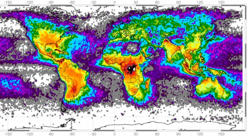
Global frequency of Lighting strikes U.S. frequency of Lighting strikes Lightning density map showing total lightning from 2015-2019. The National
Read Moredabrownstein Related post: – The Rivers of the United States as a Subway Map
Read More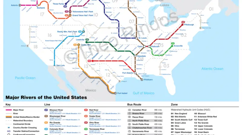
www.theodorerindos.com
Read MoreThe highest is Republican Charlie Baker of Massachusetts at 75% and the lowest is Republican Chris Christie of New Jersey
Read More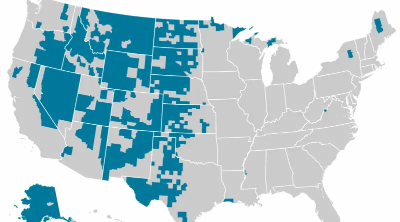
The blue counties contain 42% of U.S. land, but only 1% of the population. www.wapo.st/wnnkblog
Read More
Share of state and local road spending covered by U.S. state and local tolls, user feed and user taxes. Gas
Read MoreMost commonly detected drugs for drivers in fatal automobile accidents (1995 – 2013) www.drugtreatment.com Related posts: – Celebrating Lost Loved Ones
Read MoreReddit user: Wilson Trawick
Read MoreRelated post: – United States Old Maps
Read More