Forests and Human Settlements: A Visual Exploration
Forests are among the planet’s most vital ecosystems, absorbing carbon, supporting biodiversity, and providing resources that sustain life. Yet, human activity continuously reshapes these landscapes, influencing both the extent and density of tree cover. To understand these dynamics, we explore a series of maps that illustrate global forest cover, human settlement patterns, and the visual impact of forests from space.
Forests as Mountains: A Different Perspective
Before diving into the relationship between human settlements and tree cover, it’s useful to first understand the global distribution of forests. One of the most visually striking representations of this is Greg Fiske’s map, “Forests as Mountains.” This innovative visualization represents the world’s forests as towering mountain ranges, where the height corresponds to the volume of growing stock (total biomass in cubic meters). However, this representation only applies to certain forested areas, as vast portions of the planet remain devoid of forest vegetation.
The visualization highlights the vast, dense forests of the Amazon, the Congo Basin, and parts of Southeast Asia. The comparison to mountains underscores how these forests act as towering giants of global ecology, shaping climate and biodiversity.
Tree Cover and Human Influence
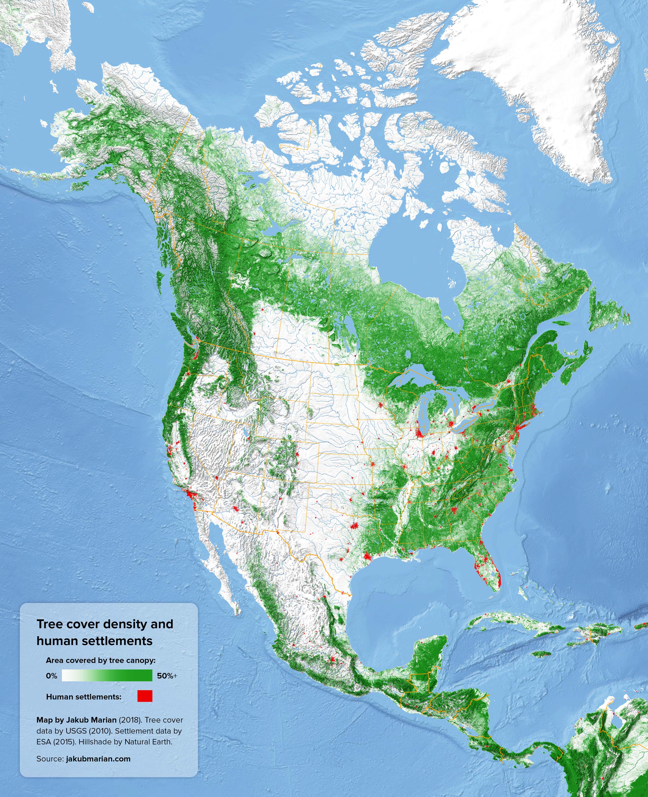
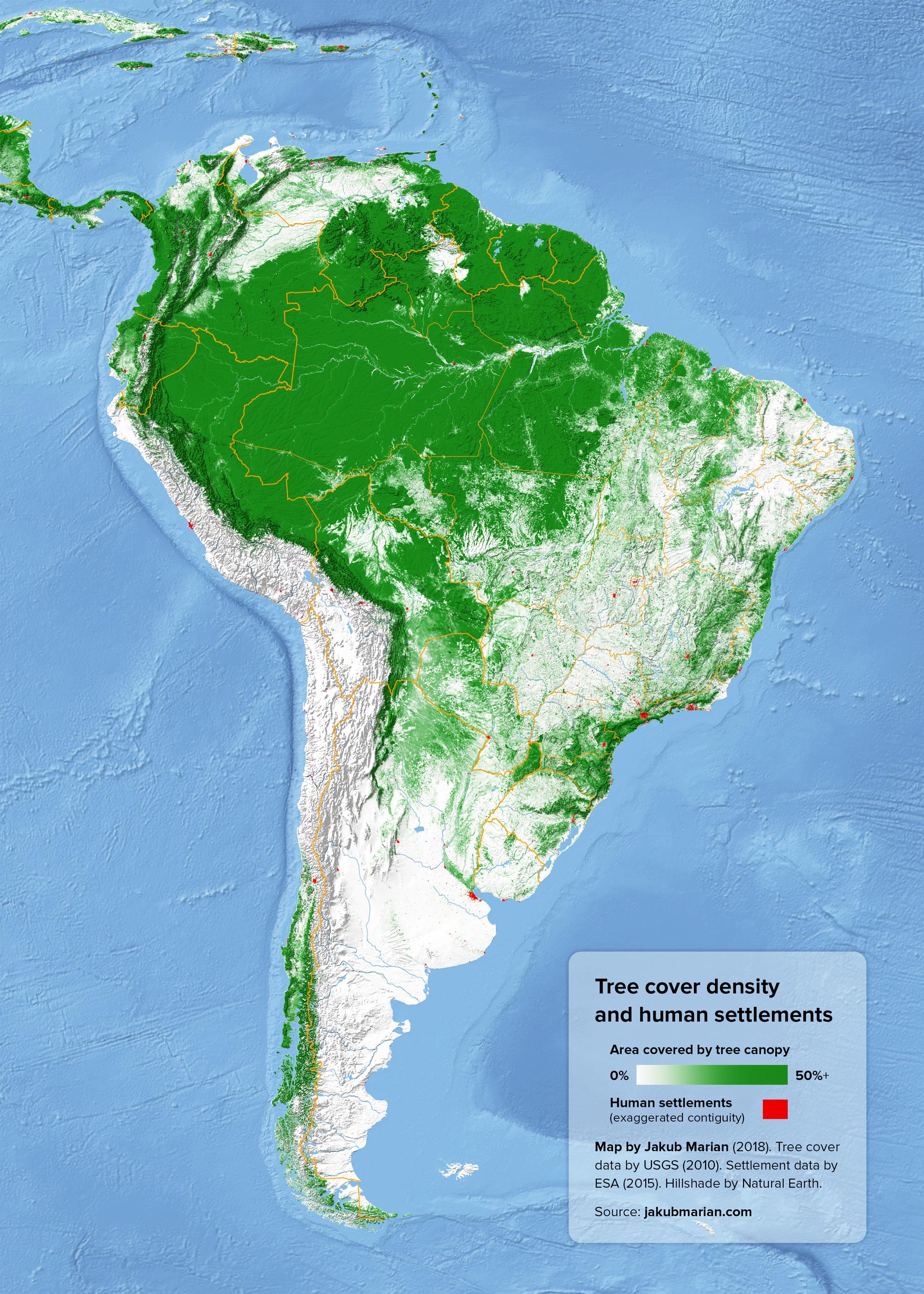
Forests have long been shaped by human activity—sometimes preserved, often diminished. While deforestation is a major concern, some regions have seen forest expansion due to conservation and reforestation efforts. The following maps by Jakub Marian provide a detailed look at tree cover density and human settlements across different continents.
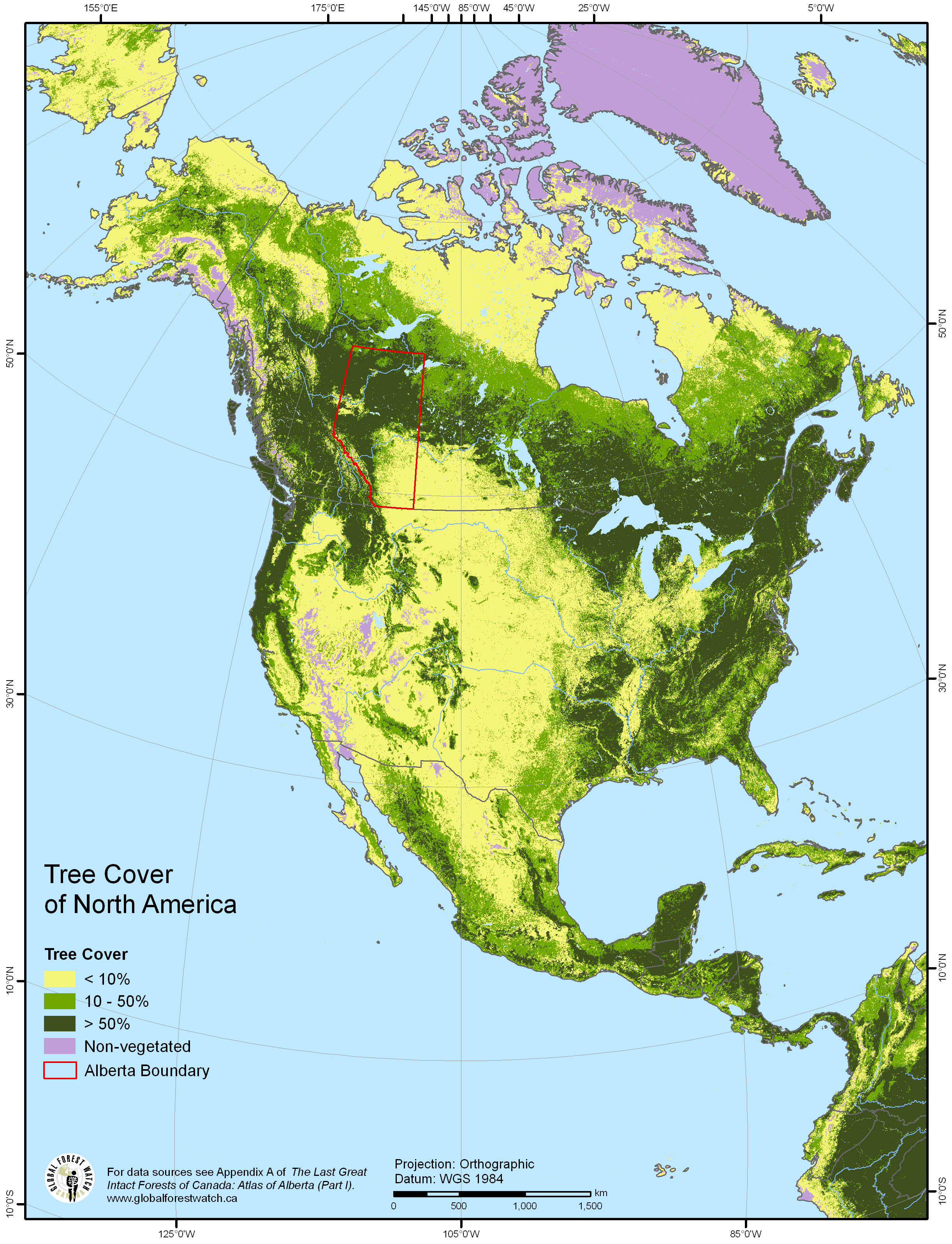
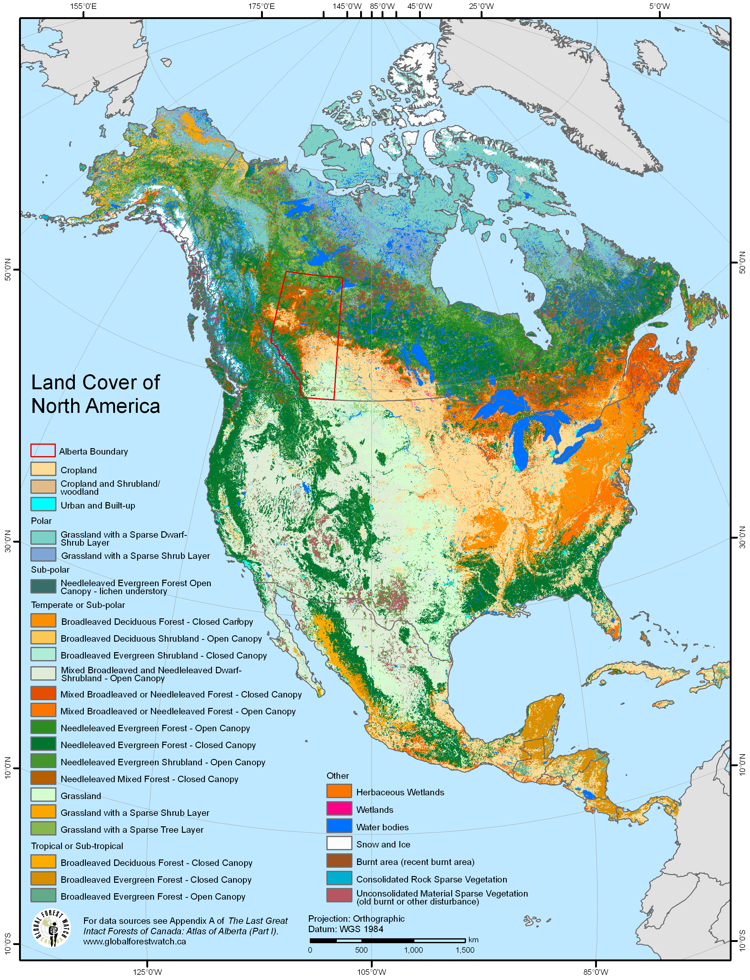
North America
In the eastern U.S. and Canada, forests are relatively dense despite significant urbanization. The western half of the continent, however, features sparser forests, with tree cover concentrated in mountain ranges.
South America
The Amazon Basin remains the most densely forested region, though deforestation is rapidly altering this landscape. Coastal areas, where human settlements are more common, tend to have less tree cover.
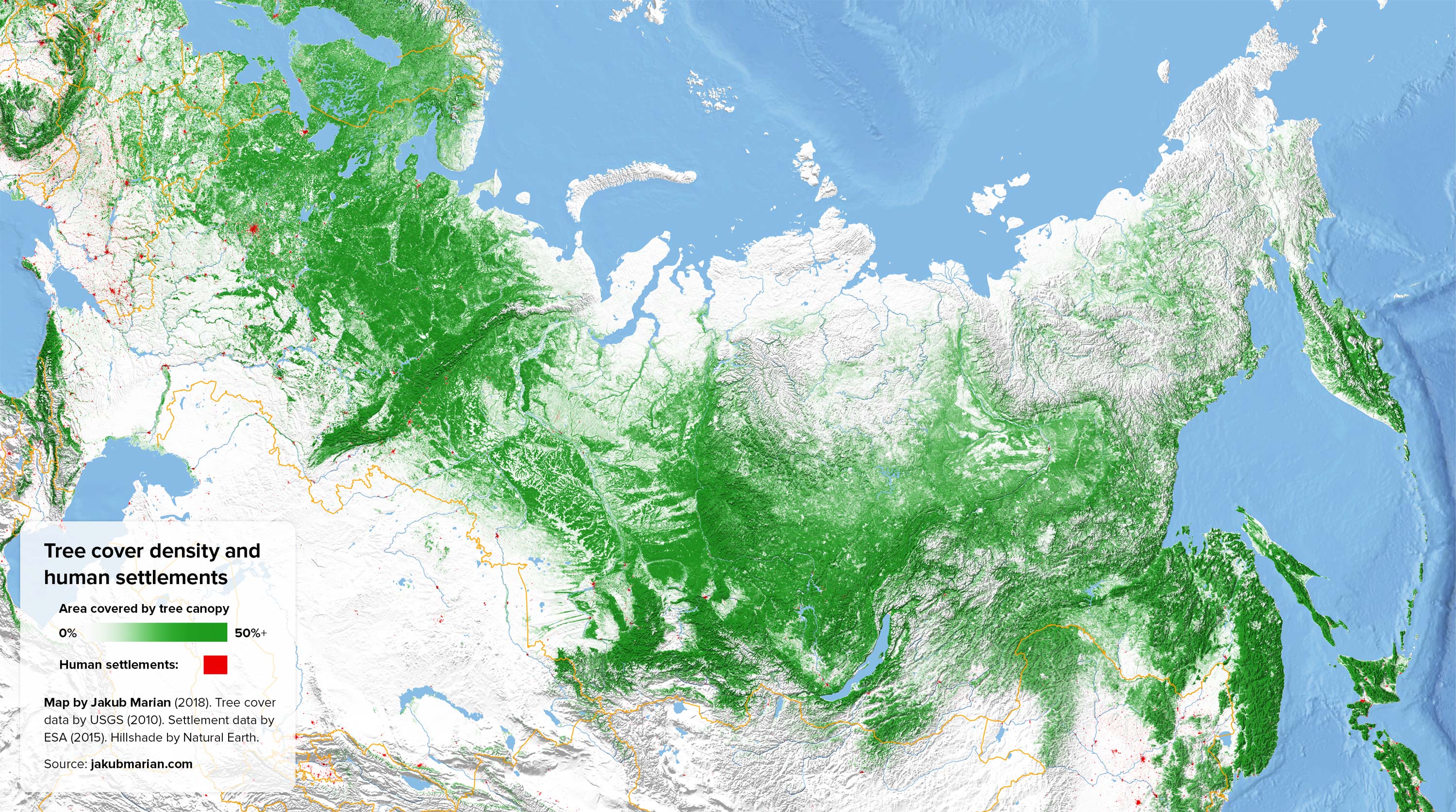
Russia and Asia
Much of Russia’s tree cover is in the sparsely populated Siberian taiga, whereas its western regions, where most of the population lives, have lower forest density. A similar trend appears in China and India, where densely populated areas have significantly less tree cover.

These maps help visualize the delicate balance between urbanization and natural landscapes. In some areas, dense forests remain intact, while in others, urban sprawl and agriculture have significantly reduced tree cover. South America, for example, holds vast tropical rainforests, but deforestation—particularly in the Amazon—continues at an alarming rate due to cattle ranching and soybean farming.
How Much of the World Is Forested?
Globally, forests cover approximately 31% of Earth’s land area, totaling 40.6 million km² as of 2020. Below is a regional breakdown based on the latest FAO data and Wikipedia:
Forest Area by Region
- Europe (including Russia): 1.44 billion hectares (14.4 million km²) – 25% of global forests
- South America: 844 million hectares (8.44 million km²) – 21% of global forests
- North and Central America: 753 million hectares (7.53 million km²) – 19% of global forests
- Africa: 637 million hectares (6.37 million km²) – 16% of global forests
- Asia (excluding Russia): 437 million hectares (4.37 million km²) – 11% of global forests
- Oceania: 185 million hectares (1.85 million km²) – 5% of global forests
Key Countries by Forest Cover
- Russia: 815 million hectares (8.15 million km²) – 49.8% of its land area
- Brazil: 494 million hectares (4.94 million km²) – 59.1% of its land area
- Canada: 347 million hectares (3.47 million km²) – 39.5% of its land area
- United States: 310 million hectares (3.10 million km²) – 33.9% of its land area
- China: 219 million hectares (2.19 million km²) – 23.3% of its land area
- Democratic Republic of the Congo: 124 million hectares (1.24 million km²) – 54.7% of its land area
- Indonesia: 91 million hectares (0.91 million km²) – 48.0% of its land area
- India: 78 million hectares (0.78 million km²) – 23.7% of its land area
- Australia: 99 million hectares (0.99 million km²) – 37.7% of its land area
The Color of Earth’s Countries from Space
One final way to appreciate the presence of forests is to view them from space. The “Dominant Color of Earth’s Countries” map, created by Reddit user Alexugna, offers a unique perspective on global land cover by analyzing the dominant color of each country as seen from satellite imagery.

This map was created using Google Maps API and k-means clustering with Python. It categorizes the most prominent colors found in satellite images, offering a simplified way to assess forest coverage. Countries with extensive forest land—such as Brazil, Peru, Venezuela, Colombia, Congo, Belarus —appear in shades of deep green. Meanwhile, arid regions, such as North Africa and the Middle East, take on sandy hues, reflecting their dry, desert landscapes.
Over time, as deforestation progresses, these colors may shift. Countries that lose significant forest cover will see their once-green shades becoming lighter, mirroring real-world environmental changes. This visualization serves as both a snapshot of the present and a warning about the future of our planet’s forests.


Land cover of North America
Tree cover of North America