Historical MapsTransportWorld 
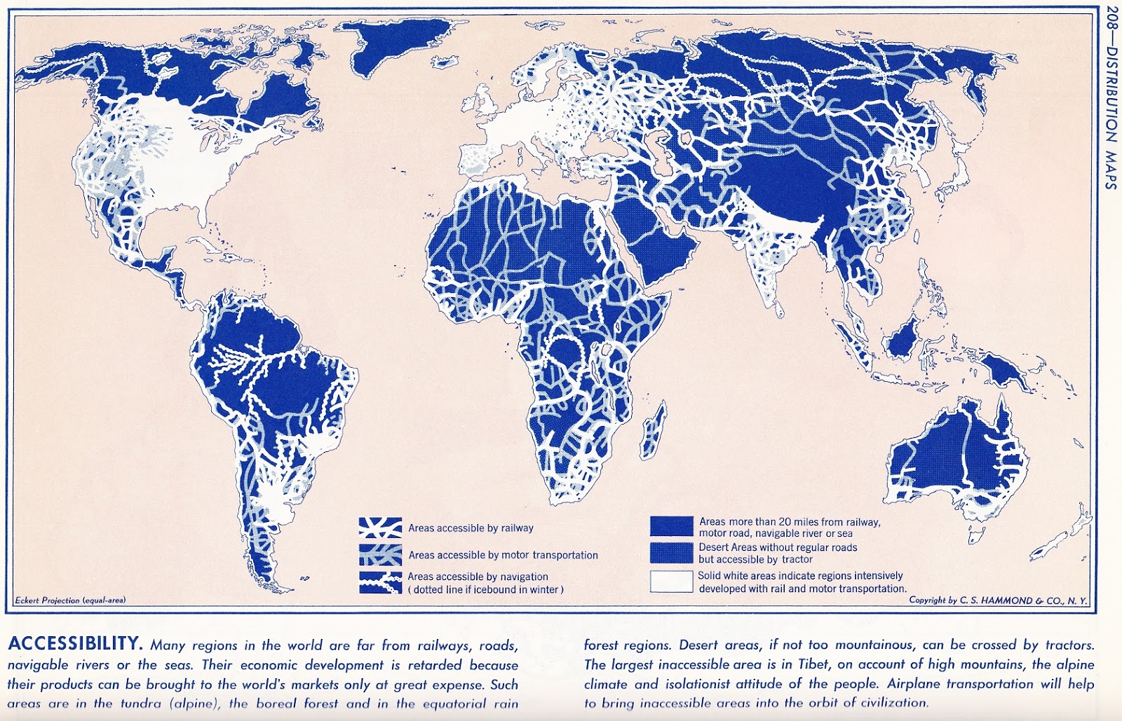
Accessibility of the World in the late 1950s June 22, 2015 Alex This post may contain affiliate links. As an Amazon Associate, we earn from qualifying purchases. Related Posts:Maps of U.S. cities with the greatest job…How the World was Imagined: First Maps and AtlasesThe Best World Atlases in 2025The Best World Map Posters In 2025A global map of AccessibilityWhat did Earth look like 600 million years ago?New York City Transportation Accessibility:…Density & accessibility of the Grand Paris (2015 - 2030)