Animated maps

Animated mapsHistorical Maps

Animated map shows Sydney’s 250-year evolution in 30 seconds

It’s been less than 250 years since the First Fleet of 1,485 settlers first arrived in New South Wales in 1788. In that relatively short time, Sydney has developed into one of the world’s largest, with a population of over 5 million. To get a better understanding of how Sydney became the modern metropolis it is today, Budget Direct analyzed dozens of maps of Sydney from the National Library of Australia and other sources from the years 1770-2020.

Read More
Animated mapsEthnic mapsNewsVivid maps

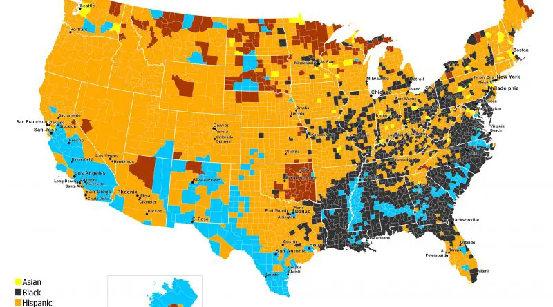
Leading group by U.S. county

The U.S. Census continues to recognize six racial categories: White American, Black or African American, American Indian and Alaska Native, Asian American, Native Hawaiian, and Other Pacific Islander. Additionally, the U.S. Census Bureau classifies Americans as “Hispanic” and “Not Hispanic,” identifying Hispanic Americans as an ethnicity distinct from others and constituting the largest minority group in the nation.

Read More
Animated mapsEthnic mapsNews

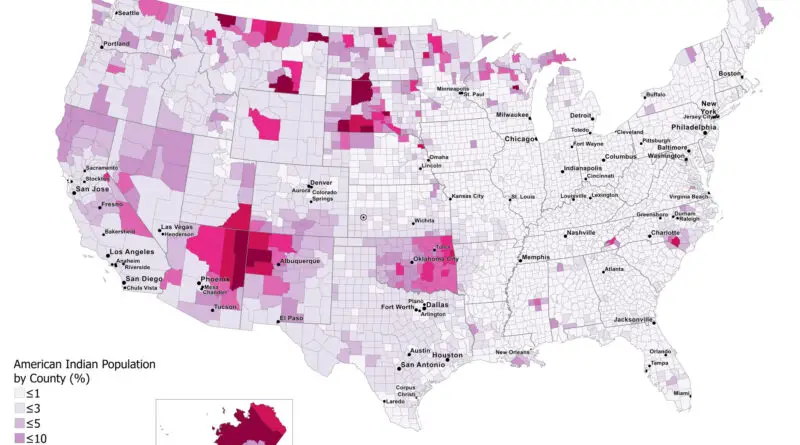
American Indian Population by County (1990 – 2022)

The American Indian population, also known as Native Americans or indigenous peoples of the Americas, comprises a diverse group of ethnicities, cultures, and languages. They are the descendants of the original inhabitants of the Americas before European colonization. The ancestors of modern American Indians arrived in America at least 15 thousand years ago from Asia. Historically, the country’s indigenous people had a population of nearly 10 million before European settlers explored America.

Read More