The total Olympic medal count per country (1896 – 2016)
Related posts: – Olympic medal cash reward – The Distribution of Olympic Talent – 2016 Olympics delegation size by nation
Read More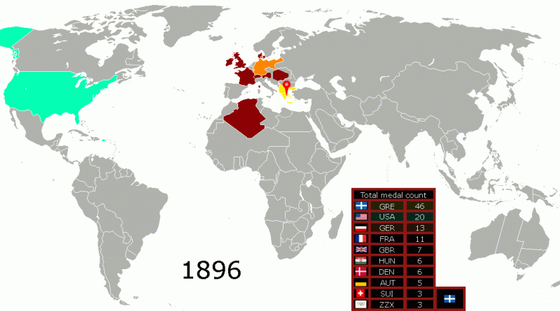
Related posts: – Olympic medal cash reward – The Distribution of Olympic Talent – 2016 Olympics delegation size by nation
Read More“Historically, many species moved great distances as climates changed. However, modern movements will be limited by the patterns of human-dominated
Read MoreRelated post: – Inglehart–Welzel Cultural Map of the World
Read More
According to the tectonic theory, the cycles of splitting apart and coming together occur because of subduction, which happens when tectonic plates meet with one another.
Read More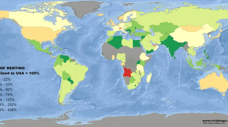
Related post: – Cost of Living Index normalized to U.S.
Read More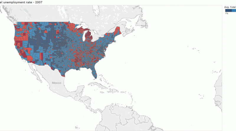
Via tableau.com
Read More
Via www.ons.gov.uk
Read More