Youth Development Index 2016 (2016)
Youth development can be achieved even in lowincome countries by providing quality education and training and allowing young people to
Read MoreYouth development can be achieved even in lowincome countries by providing quality education and training and allowing young people to
Read MoreOSM Landuse Landcover is a WebGIS application to explore the OpenStreetMap database specifically in terms of landuse and landcover information.
Read MoreThis map has been created using tree data made available by London’s local authorities and Transport for London. The map
Read MoreThe Basel Anti-Money Laundering (AML) Index is an annual ranking assessing country risk regarding money laundering/terrorism financing. It focuses on
Read MoreRelated posts: – An incredible visualisation of global shipping traffic – All the ships in the World ocean – Maritime traffic density around
Read MoreChina’s air is notoriously toxic: Each year, it contributes to the premature deaths of some 1.6 million people. Concerned about
Read More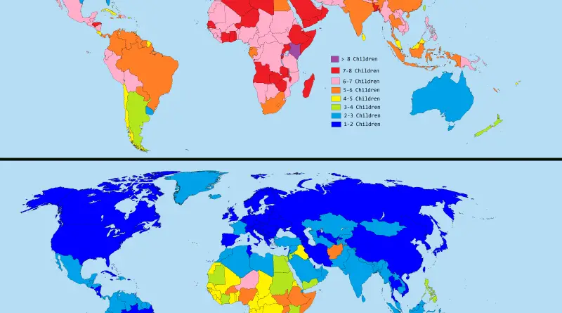
This interactive map builds on the global infrastructure networks depicted in Parag Khanna’s 2016 book “Connectography – Mapping the Future
Read More