Mapping Europe with Ptolemy’s Geographia
Claudius Ptolemy (ca. 100–170 CE) was a Greco-Roman scholar based in Alexandria, known for his work in astronomy, mathematics, and geography. In the 2nd century he compiled the Geographia (also called Guide to Geography), a text that became one of the most influential atlases of the pre-modern world.
What made the Geographia different was Ptolemy’s use of coordinates. He gathered information from earlier sources, travelers, and maps, and then recorded the latitude and longitude of about 8,000 places across Europe, Asia, and Africa. Latitude was often estimated from the sun’s height or the length of the day, while longitude was much harder, usually inferred from reported travel distances. His system wasn’t exact by modern standards, but it was groundbreaking: a way to describe the world mathematically, almost like an early geographic information system.

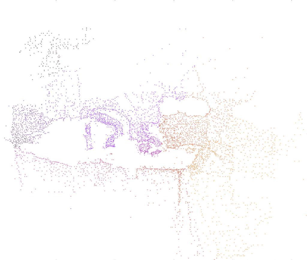
The map above, created by Reddit user chillchamp, plots Ptolemy’s European locations (The text of Geographia along with the coordinates, is available through ToposText / Greek text is here). Each dot represents a place from the work, positioned using his original coordinates. The colors form a gradient: blue for places mentioned earlier in the book, shifting to red for those listed later.
Ptolemy’s project wasn’t just about describing places – he also explained how to draw maps from his coordinates. His work covered the “habitable world” as it was known around 150 CE, stretching from the Shetland Isles to China. Forgotten in Europe for centuries, the text resurfaced in the Middle Ages and went on to shape cartography for generations.


