Map of the Square and Stationary Earth
A deep look at Professor Orlando Ferguson’s 1893 Biblical flat Earth map and the ongoing debate between scientific consensus and flat Earth beliefs in modern times.
Read More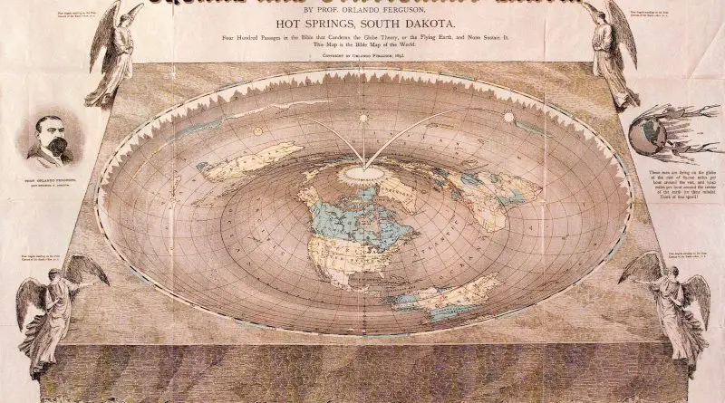
A deep look at Professor Orlando Ferguson’s 1893 Biblical flat Earth map and the ongoing debate between scientific consensus and flat Earth beliefs in modern times.
Read More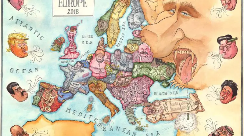
Political tensions and international relations have long been captured through satirical map posters of Europe. See how artists portray these dynamics through the ages.
Read More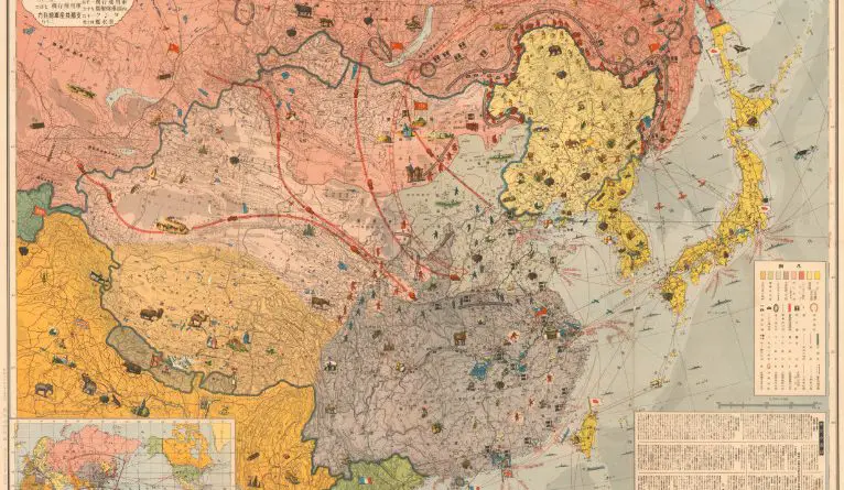
An in-depth examination of a 1937 map that captures the power struggle between Japan, China, and the USSR in East Asia, revealing the strategic tensions and resource rivalries that preceded World War II.
Read More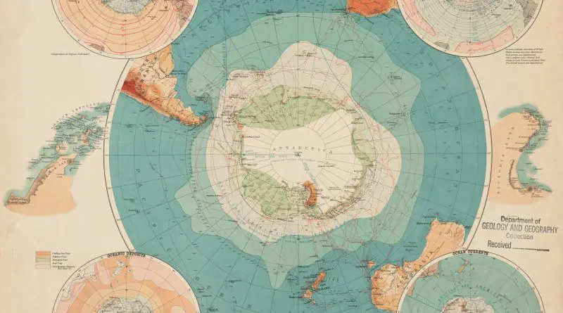
In 1898, as international interest in Antarctic exploration reached new heights, oceanographer John Murray created a remarkable map that would influence decades of polar research. This comprehensive chart combined weather data, ocean depths, and territorial claims – laying the groundwork for the golden age of Antarctic exploration.
Read More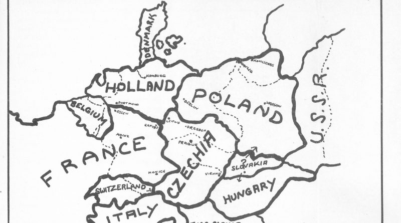
A Newark businessman’s 1941 book included a shocking map that divided Germany among neighboring countries. The Nazis turned this obscure proposal into powerful propaganda.
Read More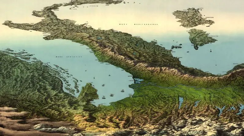
An extraordinary 19th-century panoramic illustration presents Italy from an impossible vantage point – as if viewed from high above the Alps, with the entire peninsula and Mediterranean Sea stretching toward the African continent.
Read More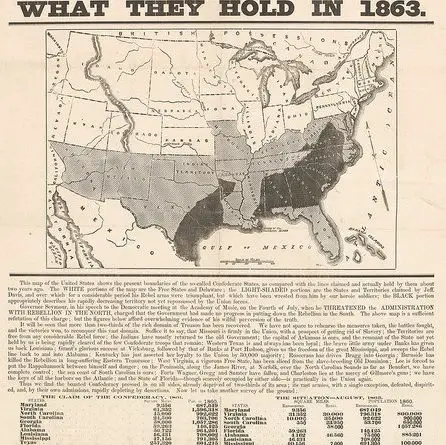
Analysis of a remarkable 1863 Civil War propaganda broadside featuring an influential persuasive map that demonstrated Union territorial gains to boost Northern morale during a pivotal moment in the conflict.
Read More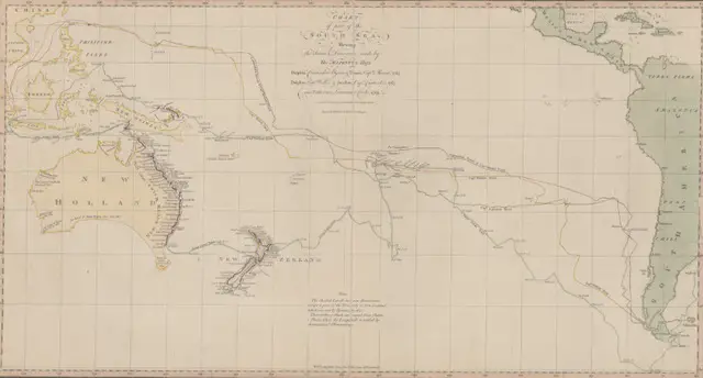
Step into the world of 18th-century exploration with this revolutionary 1770 chart of the South Sea – the first published map to show Australia’s eastern coastline and New Zealand’s complete outline. Created during Captain Cook’s first voyage, this remarkable document changed our understanding of the Pacific Ocean forever.
Read More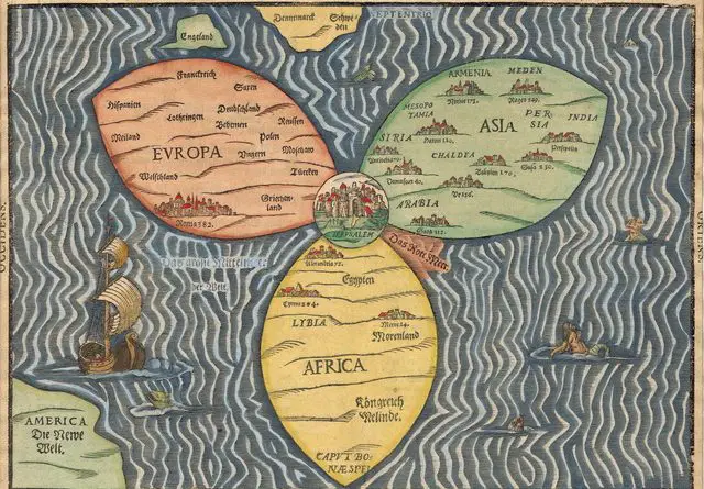
In the late 16th century, German theologian Heinrich Bünting created an extraordinary map that reimagined the world as a three-leaf clover with Jerusalem at its heart. This unusual map tells us much about how people viewed the world through a religious lens during the Renaissance period.
Read More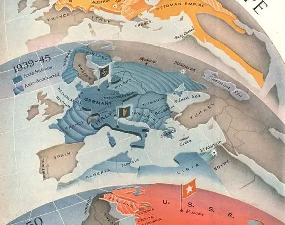
Discover how Europe’s power dynamics shifted through three major conflicts in this rare Time Magazine propaganda map series from WWI to the Cold War.
Read More