Europe Before and After the Great War
Borders of the European countries before the Great War (1915) Borders of the European countries after the Great War (1920)
Read more: Europe Before and After the Great War
Borders of the European countries before the Great War (1915) Borders of the European countries after the Great War (1920)
Read more: Europe Before and After the Great War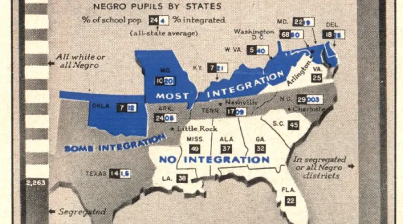
“States of integration estimated figures for public grade and high schools.”
Read more: States of integration (1957)Related posts: – Old maps and views of 18th Century London – The Great Fire of London … London maps
Read more: 17th century LondonFirst ethnographic maps appeared in the 19th century to reveal the distribution of distinct ethnic groups and languages. They focus on parts of the colonial world in which the ethnic distribution was only coming to be studied by Western scientists and those regions of Europe and Asia where the geography of ethnicity differed with political borders.
Read more: Ethnographic maps of the 19th century“A new map of the Kingdom of Denmark, comprehending North and South Jutland, Zeeland, Fyen, Laaland, and Part of Holstein.”
Read more: Denmark (1801)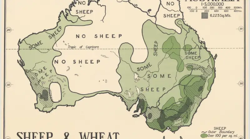
The first ship and team mapped the Australian shoreline were the Duyfken captained by Dutch explorer Willem Janszoon. He sighted the Cape York Peninsula shore in early 1606. William Dampier, an English explorer, landed on the north-west shoreline of New Holland in 1688. In 1770, James Cook cruised along and mapped the east coast, which he called New South Wales, and claimed Great Britain.
Read more: Old maps of Australia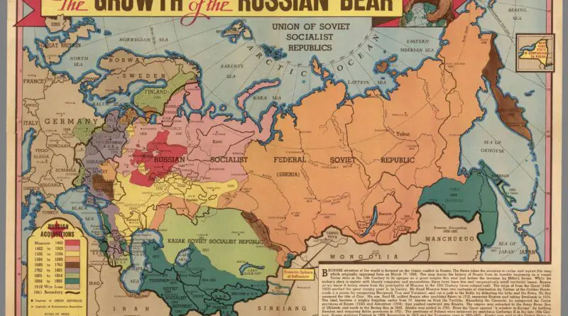
Slavic tribes began resettling into the territory currently occupied by Russia, Ukraine, and Belarus from the west in the fifth century of the Common Era. The first Russian state was established in the 9th century with centers in Kyiv and Novgorod.
Read more: Historical Maps of RussiaJapanese map published early in the 19th century depicting an enormous archipelago representing Japan at the center of the world.
Read more: People of Many Nations: Japanese map published in the 19th century