The Tory Atlas of the World
The Tory Atlas is a map plastered with nicknames instead of country names, showing how British conservatism colored attitudes towards the rest of the world.
Read more: The Tory Atlas of the World
The Tory Atlas is a map plastered with nicknames instead of country names, showing how British conservatism colored attitudes towards the rest of the world.
Read more: The Tory Atlas of the WorldIn less than a century, the United States transformed from a small coastal republic into a continental nation. Through the Louisiana Purchase, annexations, treaties, and wars, it gained territories stretching from the Atlantic to the Pacific by 1853.
Read more: Growth of United States (1776 – 1853)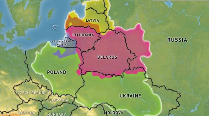
The Polish-Lithuanian Commonwealth, also known as the Republic of Both Nations, was one of the largest and most populous countries in 16th and 17th century Europe. Its formation, heyday, and eventual collapse are a fascinating tale of political prowess, cultural richness, and complex historical forces.
Read more: The Rise and Fall of the Polish-Lithuanian Commonwealth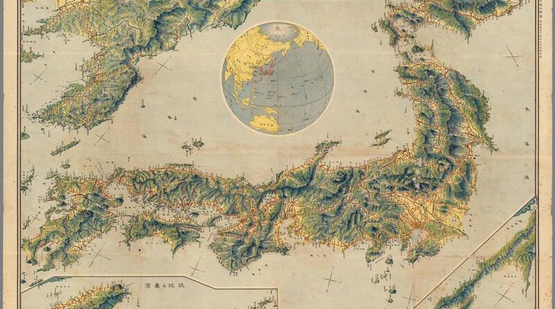
On the morning of November 3, 1921, Tokyo Asahi Shimbun readers found a large bird’s-eye map of the Japanese Empire folded inside their paper – Korea, Taiwan, Sakhalin, every railway in red, compiled by a former Army engineer. Nine days later, Japan’s delegates were in Washington D.C. for the Naval Conference that recognized Japan, for the first time, as one of five world powers.
Read more: Bird’s Eye View of Japan (1921)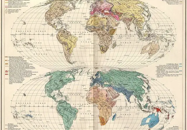
The idea of race as a rough classification of anatomically modern humans has a problematic history. Before the 19th centuries, the word ‘race’ was used in the sense of “ethnic group” and got its contemporary meaning in the area of anthropology only from the mid-nineteenth century.
Read more: Distribution of Human Races in the 19th CenturyFrench control was established over much of Northern, Western, and Central Africa by the turn of the century (including territories
Read more: Map of Africa and adjoining portion of Europe and Asia (1922)“Done in the studios of The National Geographic Magazine The map shows: – Places of interest such as Historic Monuments,
Read more: The Reaches of New York City (1939)Related posts: – New Netherland settlements & areas of influence (1614 – 1674) – Urban Scratchoff – Interactive map of
Read more: Plan of the New York City (1776)Via us-climate An urban heat island is a metropolitan area that is significantly warmer than its surrounding rural areas due
Read more: Where would capital cities be located if their 2016 temperature were matched to the 1981-2010 normalPeoples of Yugoslavia.
Read more: Ethnic map of Yugoslavia (1981)World map showing trade routes to the East and West Indies.
Read more: Trade routes to the East and West Indies (1677)Landlordism Causes Unemployment It paralyses the building trade; It Pauperises the Peasantry; 12 Landlords “own” (?) London, taking £20,000,000 a
Read more: “Landlordism Causes Unemployment”, showing an octopus strangling London (1909)