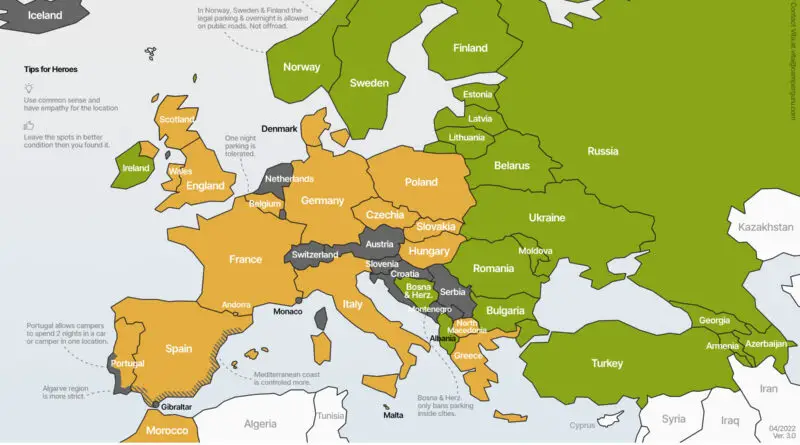
Europe’s Most Visited Countries Mapped
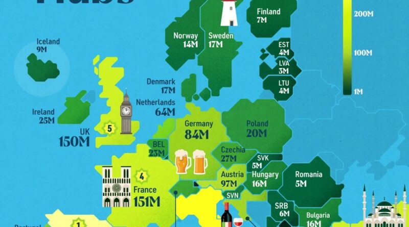
Mallorca logged 47.2 million international overnight stays in 2023. The whole of Switzerland logged 27.7 million. Spain overall reached 329 million international overnight stays, more than double France’s 150 million, even though France had more total tourist arrivals.
Read More