New York City transit frequency
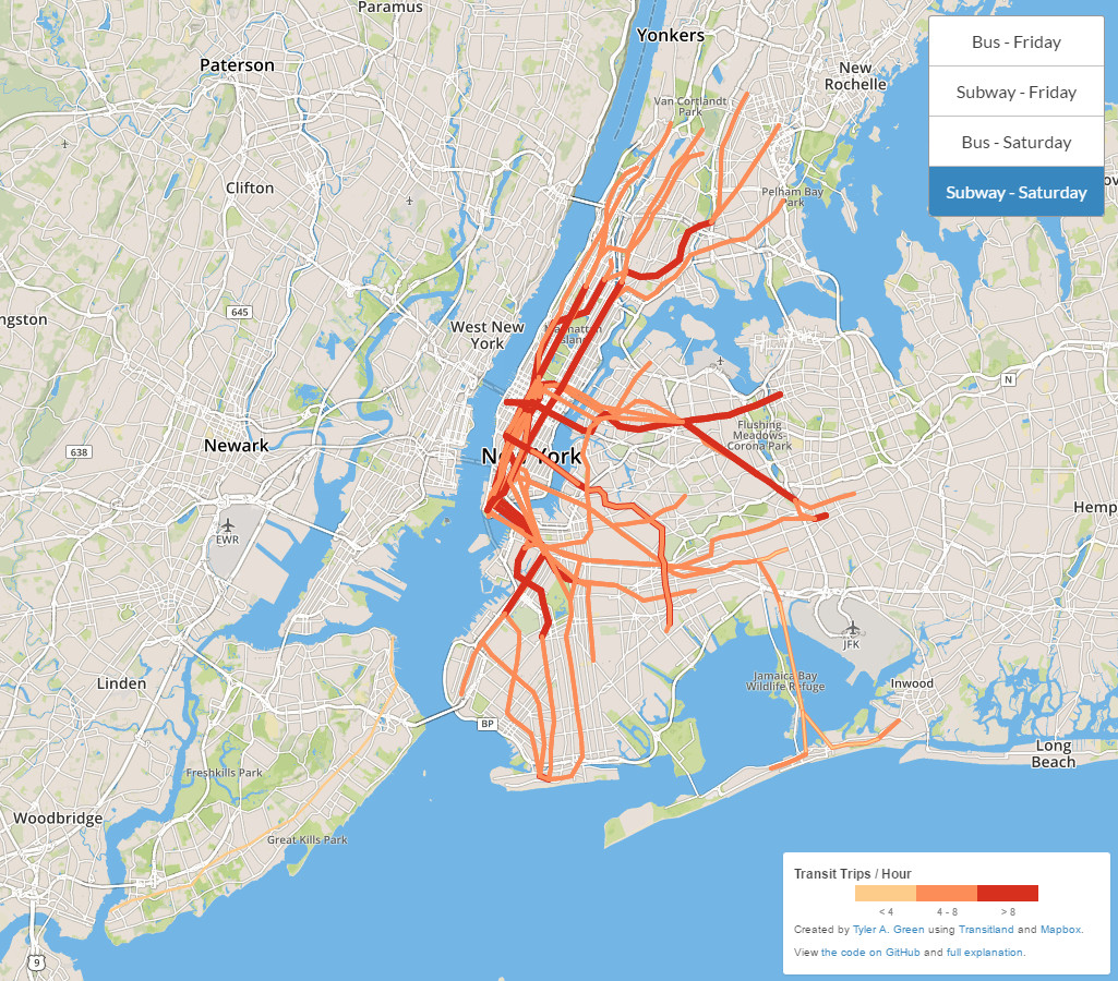
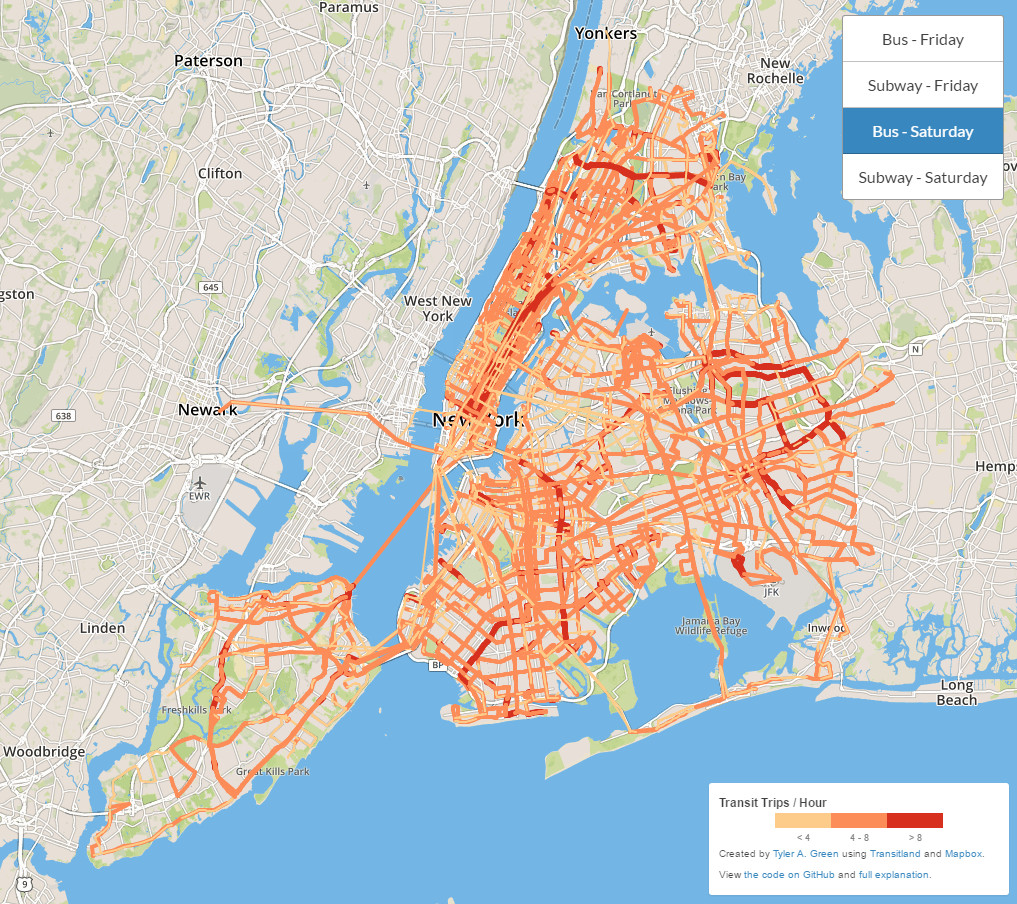
New York City transit frequency visualization.
Subway – Friday
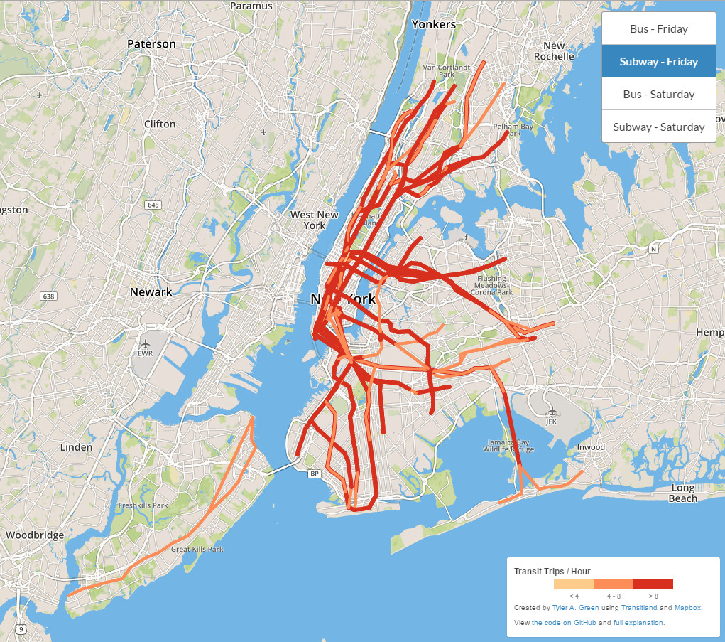
Subway – Saturday
Bus – Friday

Bus – Saturday
Related posts:
– Yellow Taxi Trips (2015)
– TV Shooting Locations in New York City
– Noise in New York City
– Mapping snow removal in New York
– New York City greenhouse gas emissions
– Energy use in NYC’s biggest buildings
– Transit Time NYC
– Mapping New York’s economy
– Animated noise complaint maps
– New York City street trees by species
– Interactive map of New York City in year 1609
– New York Citi bike most popular roads
– New York city’s schools are even more divided than housing
– Map of NYC subway system that shows how many calories you would burn walking (or swimming) between stations
– New York City felonies map
– New York City crime rank
– Death map New York
– The gangs of New York
– New York car crashes (2013 – 2015)
– Where hipsters thrive and you can’t hide
Related Posts: