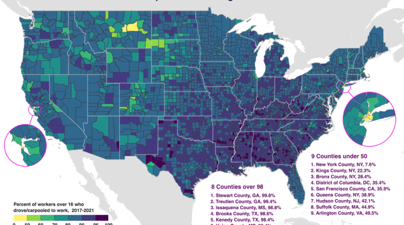
Where Nobody Lives: Maps of Earth’s Uninhabited and Wilderness Areas
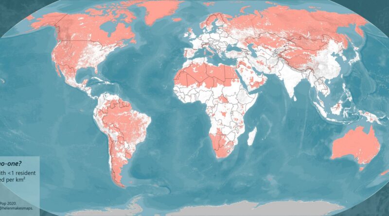
Only 5% of global landmass remains untouched by human activity. These maps show uninhabited areas across nine countries, plus global wilderness zones with minimal human footprint. Even in densely populated Netherlands, green spaces persist where no one lives.
Read More