Skip to content
Vivid Maps Logo

  • Atlases
  • Map Posters
  • Scratch Maps
  • Globes
  • Videos
Sport
September 9, 2017 Alex

Closest NCAA D1 Hockey Program to Each U.S. County

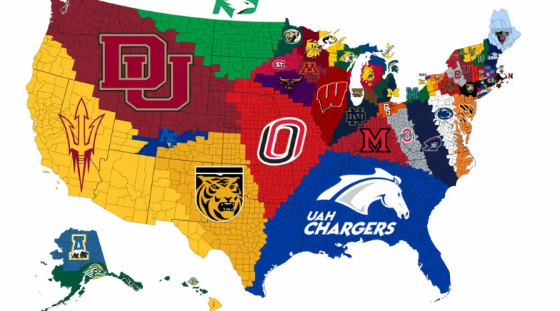
Reddit user: JohnDoeMonopoly

Read More
Economic maps
September 9, 2017 Alex

South American national subdivisions by GDP per capita

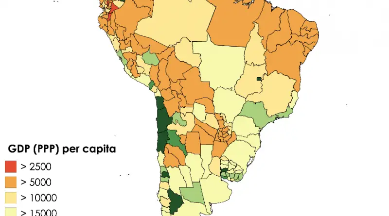
Brazil heads the regional ranking, accompanied by Mexico, Argentina, and Colombia. Uruguay is the South American nation with the highest average income per capita, with about 16,190 U.S. dollars per person per year (2019).

Read More
Crime mapsMapping Stereotypes
September 9, 2017 Alex

Top Design Trends in Every U.S. State

The most-search interior design style in each US State.

Read More
Old maps
September 8, 2017 Alex

“Landlordism Causes Unemployment”, showing an octopus strangling London (1909)

Landlordism Causes Unemployment It paralyses the building trade; It Pauperises the Peasantry; 12 Landlords “own” (?) London, taking £20,000,000 a

Read More
AgricultureImmigrationInternetWorld
September 8, 2017 Alex

Banknotes World Map

Reddit user: Bandard

Read More
Linguistic maps
September 8, 2017 Alex

United States placename etymology

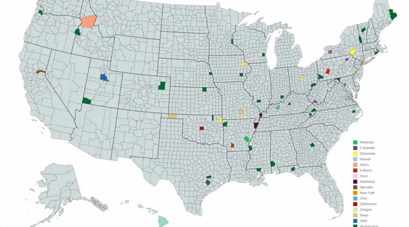
Many states the U.S. have counties named after American presidents . U.S. Counties are also regularly named after notable people, regional Native American societies formerly in the area, cities placed in the county, and land or water features.

Read More
Animated mapsEthnic maps
September 7, 2017 Alex

Languages Spoken in London Mapped

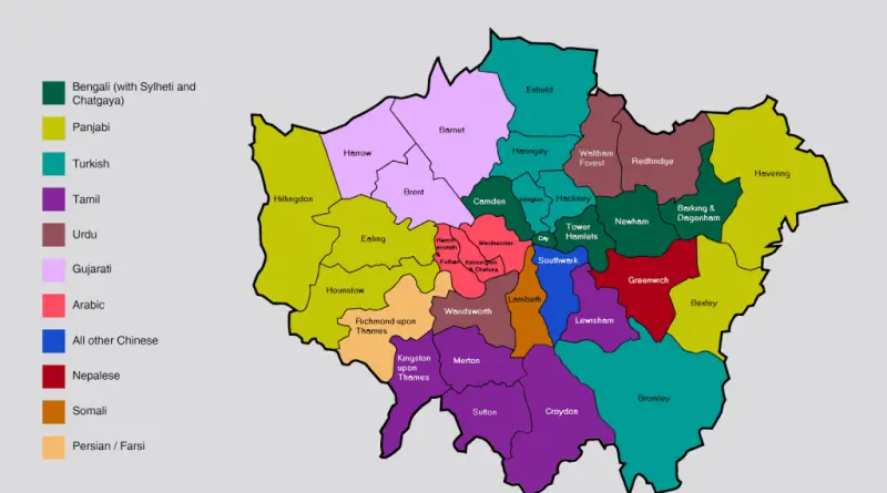
More than 250 languages are spoken in London, making the capital of the UK the most linguistically diverse city globally. About 78% of residents have English as their first language. Nearly 1.7 million Londoners don’t have English as their 1st language. More than 300,000 people living in London can’t speak English.

Read More
Mapping StereotypesNatural disastersNature
September 7, 2017 Alex

The path of every recorded Western hemisphere Hurricane

The path of every recorded Atlantic Hurricane since 1851 Source: portabledavers A map of all Western hemisphere hurricanes, color coded

Read More
Crime mapsInteractive mapsMapping Stereotypes
September 7, 2017 Alex

New York City cycling incident map

New York City cycling incident map and cyclists injured by borough, by month, an hour of day charts. Related post: – New

Read More
Climate
September 7, 2017 Alex

Detailed Climate Map Of The United States

The United States’ climate is influenced by a variety of factors, including latitude, elevation, proximity to oceans, and prevailing wind patterns, resulting in a diverse range of climates across the country.

Read More
Page 151 of 679« First«...102030...149150151152153...160170180...»Last »

Trending now

  • nglish names and Latin translations
    U.S. State Names Translated into Latin
  • The Price of Sex around the World Mapped

Related Products

Push pin maps · Globe drinks cabinets · Maps of the United States · Board games · Monopoly · Map-based strategy board games · History Board Games · Coloring Books · Handheld GPS · GPS Watches · GPS Trackers

Vivid Maps Tools

· Convert Latitude/Longitude
· Elevation Finder
· Distance Calculator
· Kilometers to Miles Converter
· Kilograms to Pounds Converter
· Liters to Gallons Converter
· Temperature Converter
· Antipodes Map
· Find cities with a similar climate
· Find cities with a similar climate (2050)
· How hot cities could be in 2050
· The U.S. Population Lines

About
Privacy Policy

Copyright © 2026 Vivid Maps. All rights reserved.