Evolution of U.S. States with a focus on the Confederate States (December 20, 1860 – July 15, 1870)
Related posts: – USA boundary evolution – Territorial evolution of North America of non-native nation states from 1750 to 2008
Read More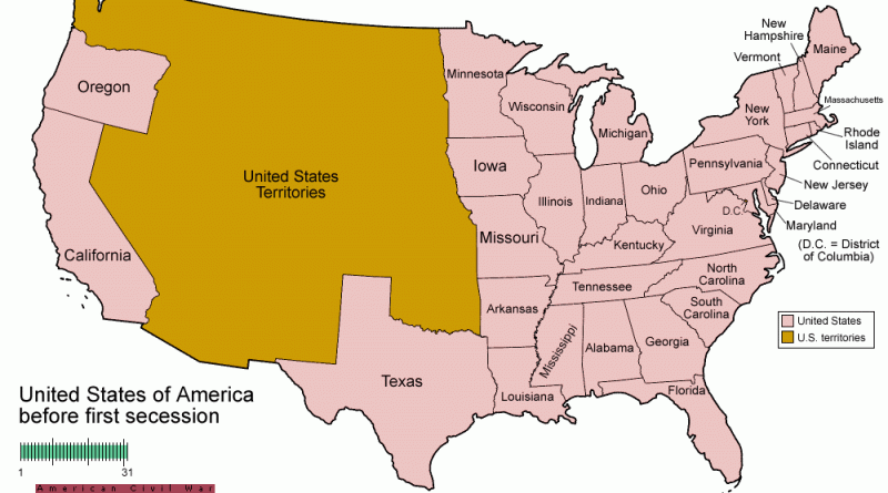
Related posts: – USA boundary evolution – Territorial evolution of North America of non-native nation states from 1750 to 2008
Read MoreThe U.S. has approximately 250 fresh-water lakes known to have surface areas of 13,700 square miles or more. Nearly one hundred are in Alaska, and 100 in Minnesota, Wisconsin, Michigan, New York, and Maine. 23 U.S. states have all the lakes of 10 square miles or more and numerous smaller lakes.
Read More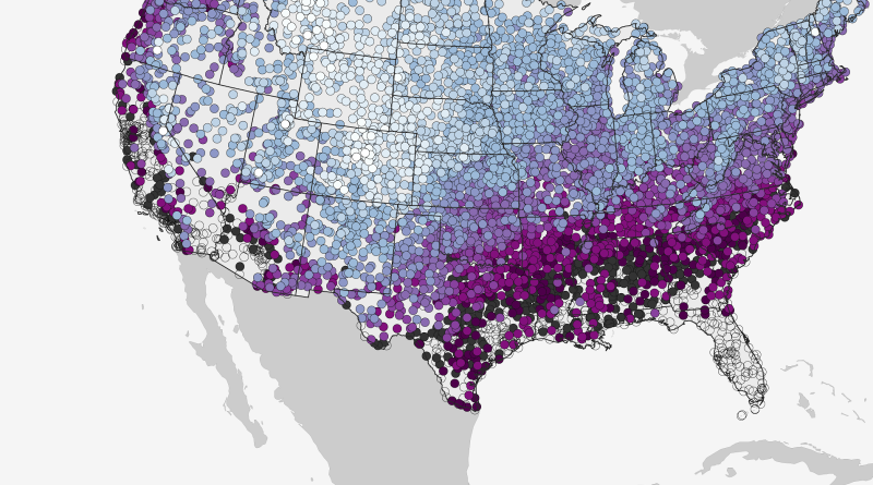
This map shows the historic date by which there’s a 50% chance of at least 0.1” of snow on the
Read More– Berlin: superimposed on Bern/Mittelland region (983 km2) – New York: superimposed on the Greater Zürich Area (2103 km2)
Read More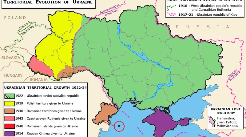
History of Ukraine (since 600 BC)
Read MoreSan Francisco lags with only 2.2% in jobs from startups. This was only slightly higher than the United States metro
Read MoreDid you know from 1890 to 1958 the British Columbia Electric Railway Co. Ltd. installed and operated interurban and streetcar
Read MoreThis interactive demo displays the location of every bus and rail vehicle from TriMet in Portland, Oregon at any point
Read More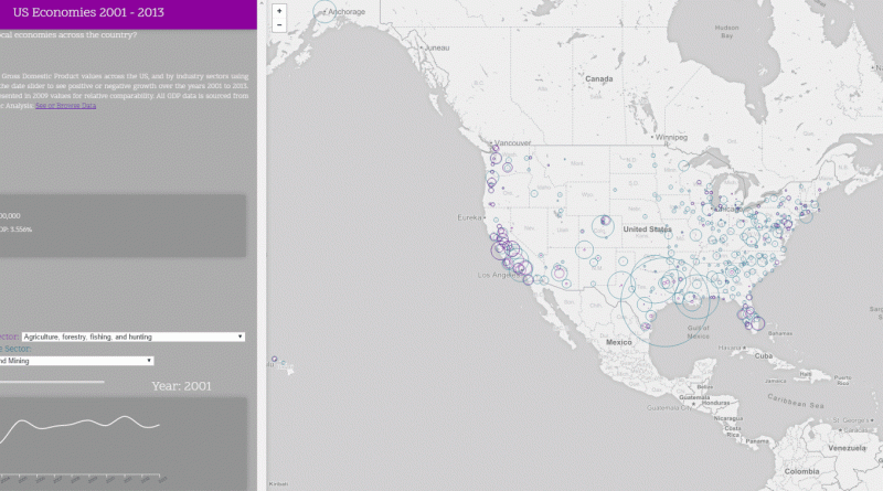
Compare metropolitan Gross Domestic Product values across the United States, and by industry sectors using the data selector. Use the
Read More