Syrian refugees find new homes in the USA
More than 5,000 Syrian refugees have settled in the U.S. since October -even in the states where governors said they
Read MoreMore than 5,000 Syrian refugees have settled in the U.S. since October -even in the states where governors said they
Read More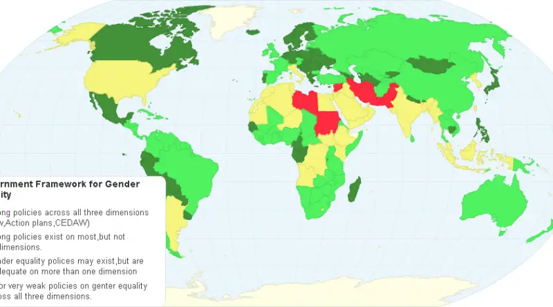
Gender equality, also known as sex equality, gender egalitarianism, sexual equality, or equality of the genders, is the view that
Read More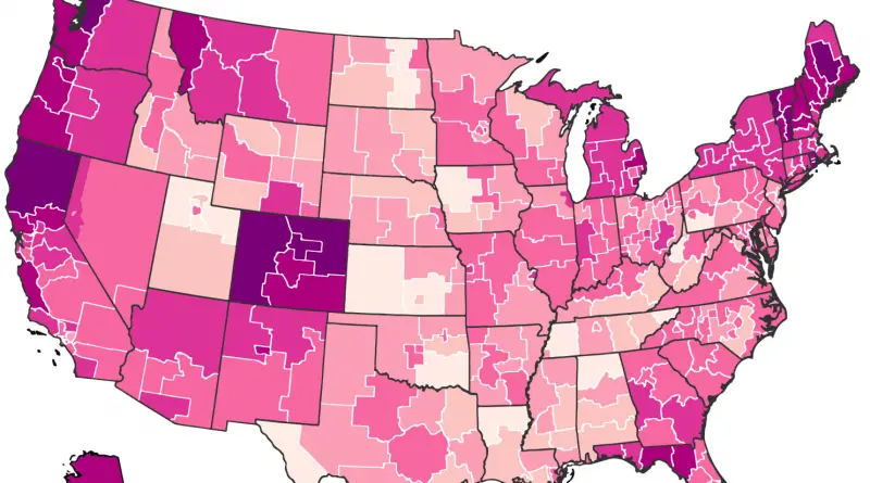
Via washingtonpost.com Related posts: – Mapping the spread of America’s drug overdose epidemic – How States are Prescribing Opioid Painkillers
Read More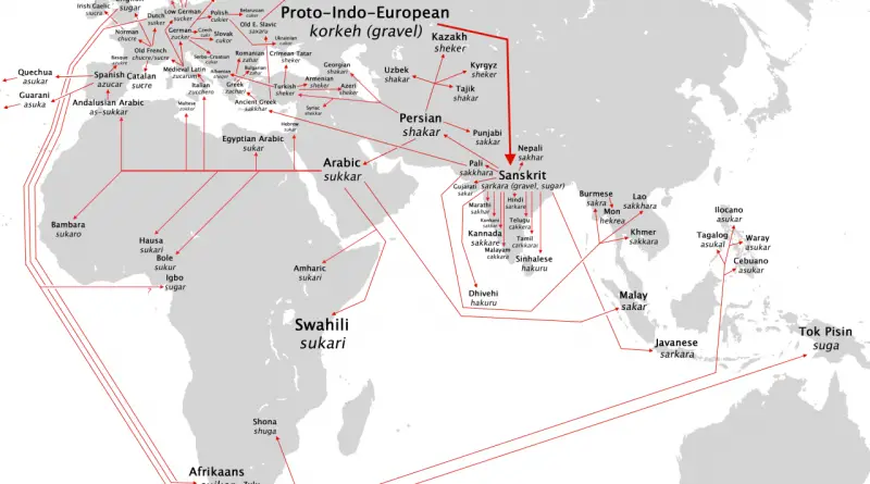
Related posts: – The spread of the word for “coffee” – The spread of the word for “tea”
Read More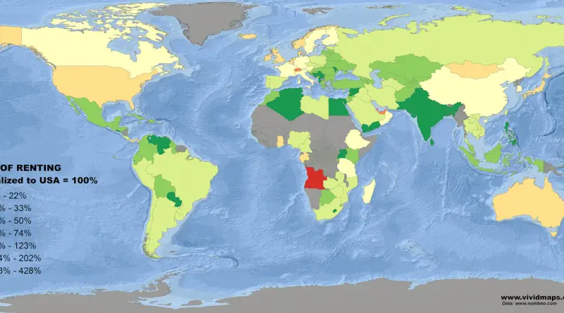
Related post: – Cost of Living Index normalized to U.S.
Read More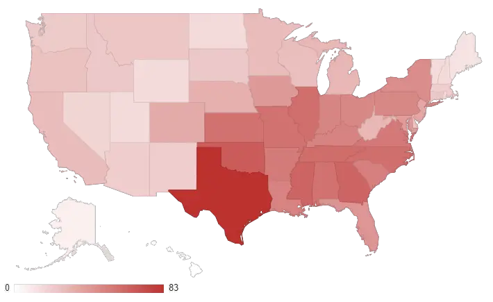
The map below reflects a summation of billion-dollar events for each state affected. From 1980–2016, there have been 23 drought
Read MoreWyoming and West Virginia follow New Jersey as the number two and three states with the highest percentage of workers
Read MoreVia radicalcartography.net
Read More
Canada has a total area of about 10 million square kilometers (~4 million square miles) and makes up about half of the territory of North America. Canada is the second-largest country in the world after Russia.
Read More