Paper sizes world map
8.5×11 has been around for more than a century. 8.27×11.69 was made an international standard in the 1970s. Most of Europe had already adopted it since the 20s.
Read More

8.5×11 has been around for more than a century. 8.27×11.69 was made an international standard in the 1970s. Most of Europe had already adopted it since the 20s.
Read More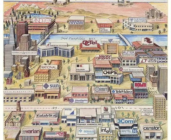
View of the United States from San-Francisco is an illustration showing how Silicon Valley residents see the rest of the U.S. Designed by Kirby Scudder, it was first published as the cover for the Pacific Ventures (1986).
Read More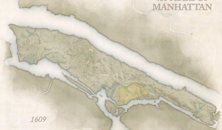
Manhattan has changed substantially over the past 400 years. With the millions of people who live there and the many more who commute to the island on a daily basis, Manhattan has become a metropolis of concrete, culture, and big-city life.
Read More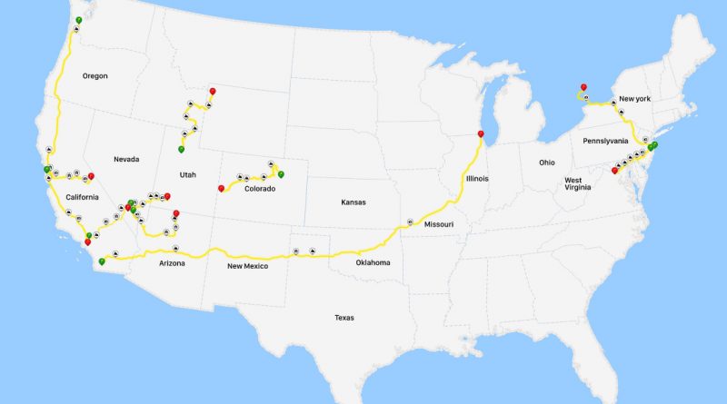
From the Pacific Coast Highway to the Great River Road, explore the most iconic road trips across America. These detailed maps showcase everything from scientifically optimized routes connecting major landmarks to social media’s favorite drives and wonderfully weird roadside attractions.
Read More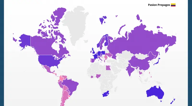
The Prostitution business makes US$186 billion per year. According to Economist, In 2006, the cost for one hour of sex with a female prostitute averaged $340 worldwide. Nowadays, the average rate is down to $260. Prostitution is legal in about 52% of the world, limitedly legal in 12%, and illegal in 35%.
Read More
Human Development Index is usually presented on a national level. However, the Human Development Index can vary a lot within a country.
Read More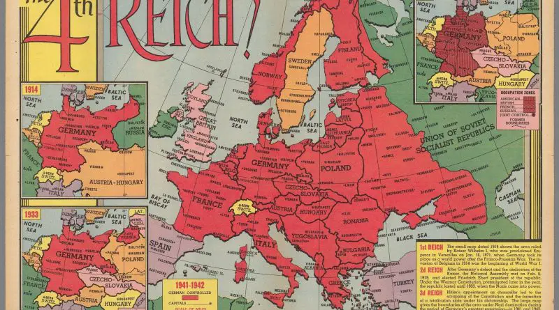
This is a 1947 map depicting the “What If” following the end of the Second World War in Europe. The
Read More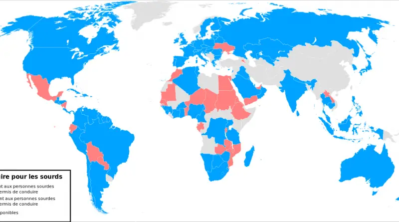
According to the World Federation, in 26 countries, deaf people are not allowed to drive a car.
Read More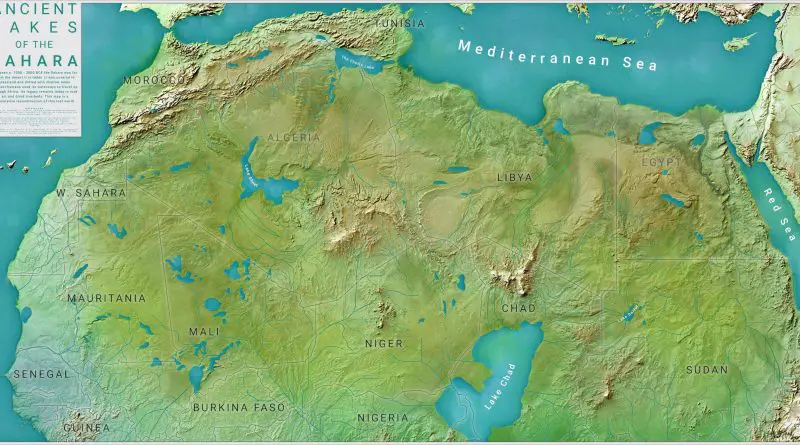
Between c. 7000 – 3000 BCE the Sahara was far from the desert it is today. It was covered in grassland and dotted with shallow lakes. Ancient humans used its waterways to travel up through Africa. Its legacy remains today in rock art and dried riverbeds. This map is a speculative reconstruction of this lost world.
Read More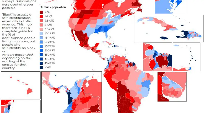
In most Americas countries, the black population was concentrated where there were originally plantations and where slaves went.
Read More