How Paid Vacation Varies Around the World
How much paid leave do workers get around the world? This maps reveal major global differences – from generous European policies to countries where paid vacation is rare.
Read More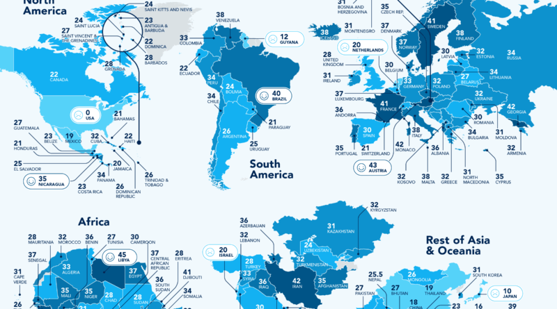
How much paid leave do workers get around the world? This maps reveal major global differences – from generous European policies to countries where paid vacation is rare.
Read More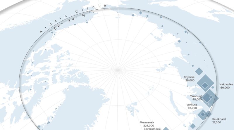
From Tromsø to Murmansk, life above the Arctic Circle isn’t as sparse as you might think. Here’s a closer look at the largest towns in the Arctic—and why most of them are in Russia.
Read More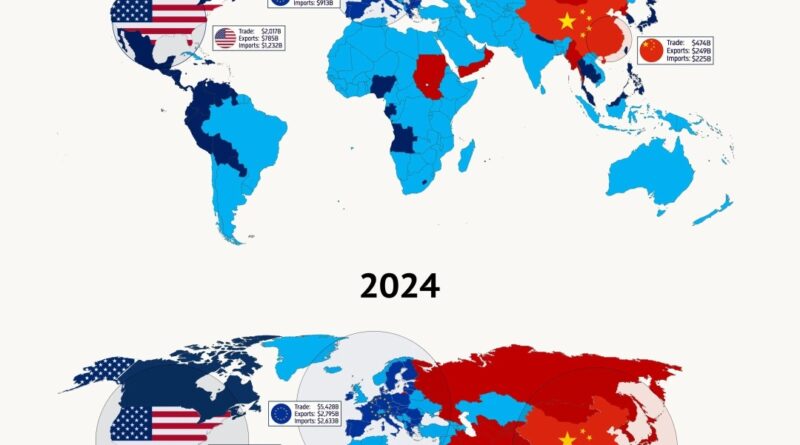
A side-by-side world maps show how global trade has changed since 2000. China has rapidly expanded its influence, becoming the top trading partner for much of the world – overtaking both the U.S. and the EU in many regions.
Read More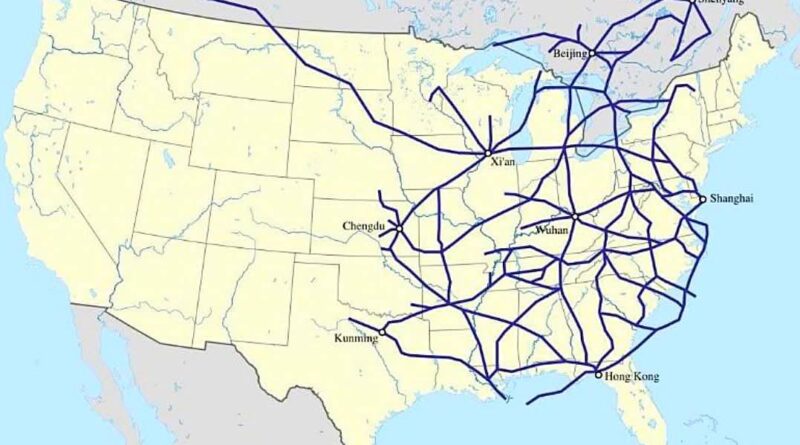
China started building railways in the 19th century – just like the Untied States – but when it comes to high-speed rail, it’s left the U.S. in the dust.
Read More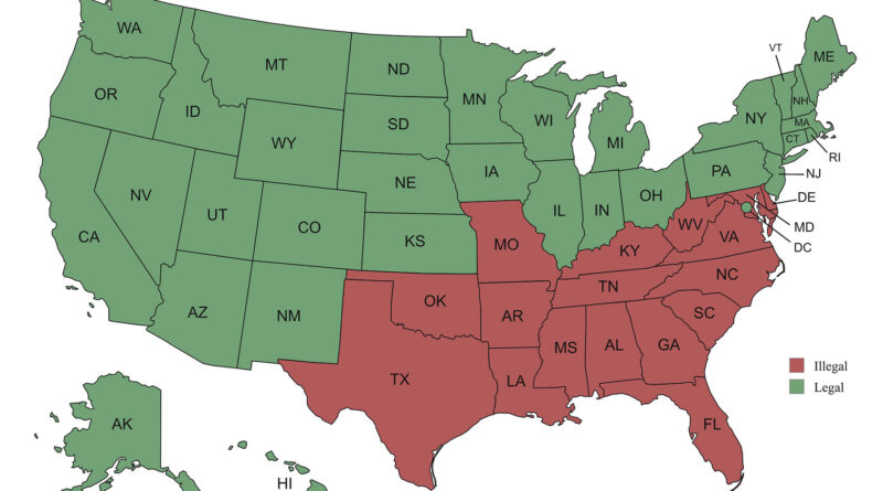
It’s hard to believe, but until 1967, marrying someone of a different race was still illegal in parts of the U.S. This map shows where those bans were still in place just one year before the Supreme Court struck them down for good.
Read More
Steel or concrete? A closer look at 743,398 bridges across the U.S. reveals which material wins out – by county. This colorful map based on the latest 2025 National Bridge Inventory shows how bridge-building choices differ from place to place.
Read More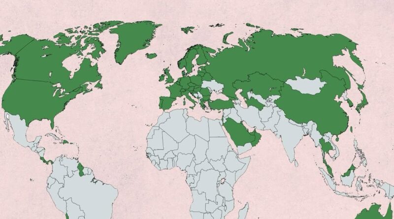
This map shows which countries have a GDP per capita (PPP) above the global average. It offers a clear visual of the world’s economic divide – where wealth is concentrated, and where it’s not.
Read More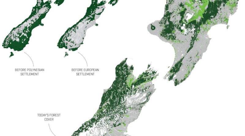
From forest-covered islands to today’s mix of pine plantations, pastures, and native remnants—these three maps help explain how New Zealand’s geography was reshaped by human arrival, fire, and farming.
Read More
Forecasting hurricanes used to feel like watching a storm through frosted glass. Today, we have a much sharper view. This post explores how the “cone of uncertainty” has narrowed – and what that means for safety, science, and storm prep.
Read More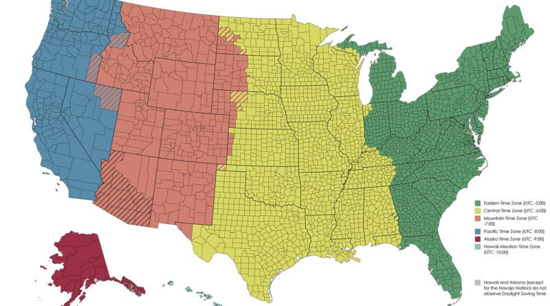
Ever wondered why Arizona seems to ignore daylight saving time? Or why some towns in Indiana run an hour ahead of their neighbors? This map explains how U.S. time zones work, and why they don’t always make sense.
Read More