The ‘Real’ Map of Europe: It’s Bigger Than You Think
Ever looked at a standard map of Europe and thought something was missing? You’re right. The Europe we usually see in atlases and on wall maps tells only part of the story.
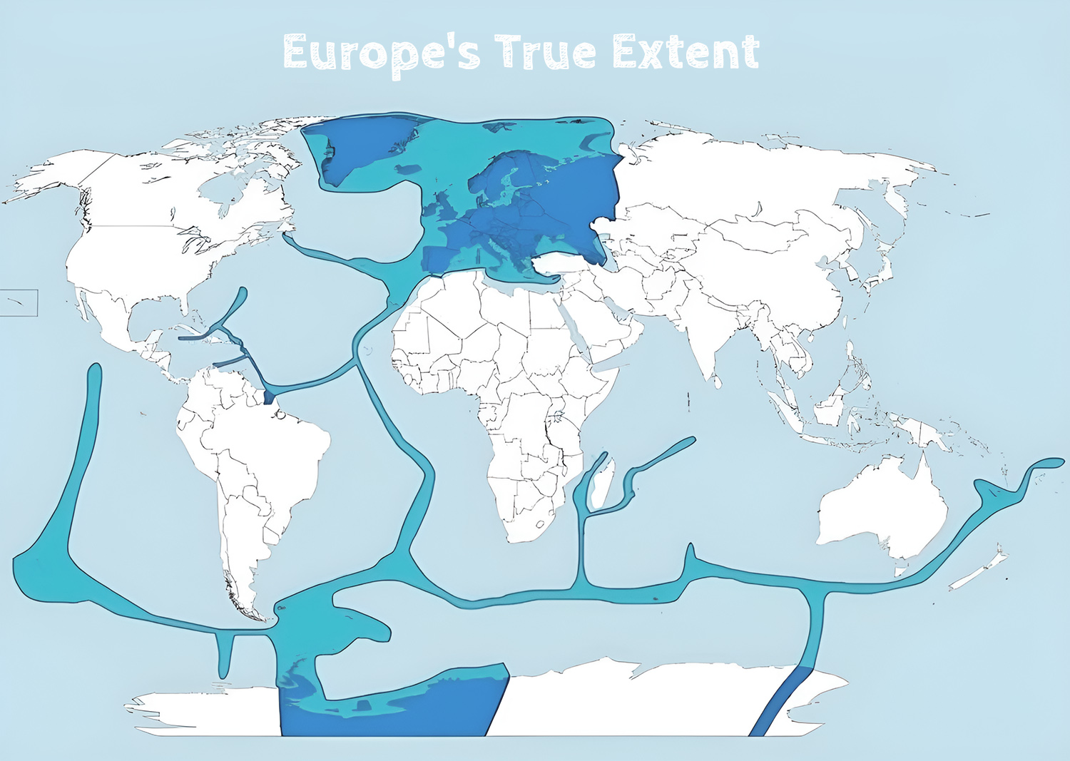
Take France, for example. While most people picture the hexagonal shape of metropolitan France, French citizens are just as much at home on the beaches of Martinique or in the mountains of Réunion Island. And that’s just the beginning.
Where Does Europe Really End?
Here’s a breakdown of how far European countries stretch across the globe, based on recent data from national statistics offices and the CIA World Factbook:
| Country | Major Overseas Territories | Total Area (km²) | % of Country’s Total Area |
| France | French Polynesia, New Caledonia, French Guiana, Réunion, Mayotte | 119,394 | 18.2% |
| United Kingdom | Falkland Islands, British Indian Ocean Territory, Bermuda, Cayman Islands | 17,968 | 7.3% |
| Denmark | Greenland, Faroe Islands | 2,186,283 | 98.1% |
| Netherlands | Aruba, Curaçao, Sint Maarten, Caribbean Netherlands | 993 | 2.4% |
| Spain | Canary Islands, Ceuta, Melilla | 7,492 | 1.5% |
| Portugal | Azores, Madeira | 3,171 | 3.4% |
| Norway | Svalbard, Jan Mayen | 62,674 | 16.2% |
Cool Facts You Probably Didn’t Know
Here’s something that blows most people’s minds: France has more time zones than any country except Russia. Thanks to its territories spread across every ocean, the French can celebrate New Year’s Eve 12 different times!
And Denmark? It looks tiny on European maps, but thanks to Greenland, it’s actually one of the world’s largest countries by area. That’s like having a tiny apartment in the city but owning a massive ranch in the countryside.
The British Empire might be history, but here’s a fun fact: the sun still hasn’t set on British territories. There’s always at least one piece of British-administered land in daylight.
The European Footprint in Antarctica
You might think Antarctica is just ice and penguins, but European countries are quite busy down there. They’re not claiming territory (that’s not allowed), but they’re running some pretty impressive scientific bases:
- French scientists at Dumont d’Urville Station are figuring out what’s happening with our climate
- British researchers at Halley Station have been keeping an eye on the ozone layer since the 1950s
- Norwegian and German teams run year-round bases studying everything from weather patterns to penguin populations
What This Means Today
These aren’t just leftover dots on old colonial maps. Millions of people in these territories are European citizens, even though they might live closer to New York than Paris, or closer to Sydney than London. These places give European countries access to vast ocean resources and strategic locations worldwide.
Some of these territories, like France’s overseas departments, are just as much part of their European country as any mainland region. Others have their own governments but maintain close ties with their European partners.
What’s your take on all this? Did you know Europe stretched so far beyond its continental borders? Have you ever visited any of these distant European territories? Drop a comment below – I’d love to hear your stories or which facts surprised you the most.


