North America is a continent rich in diverse landscapes, from towering mountains and vast plains to dense forests and arid deserts. Among these features, rivers and their basins play a crucial role in shaping the geography, ecology, and human activities of the continent. This article delves into the intricate network of North American rivers, highlighting their lengths, flow rates, and basin areas.
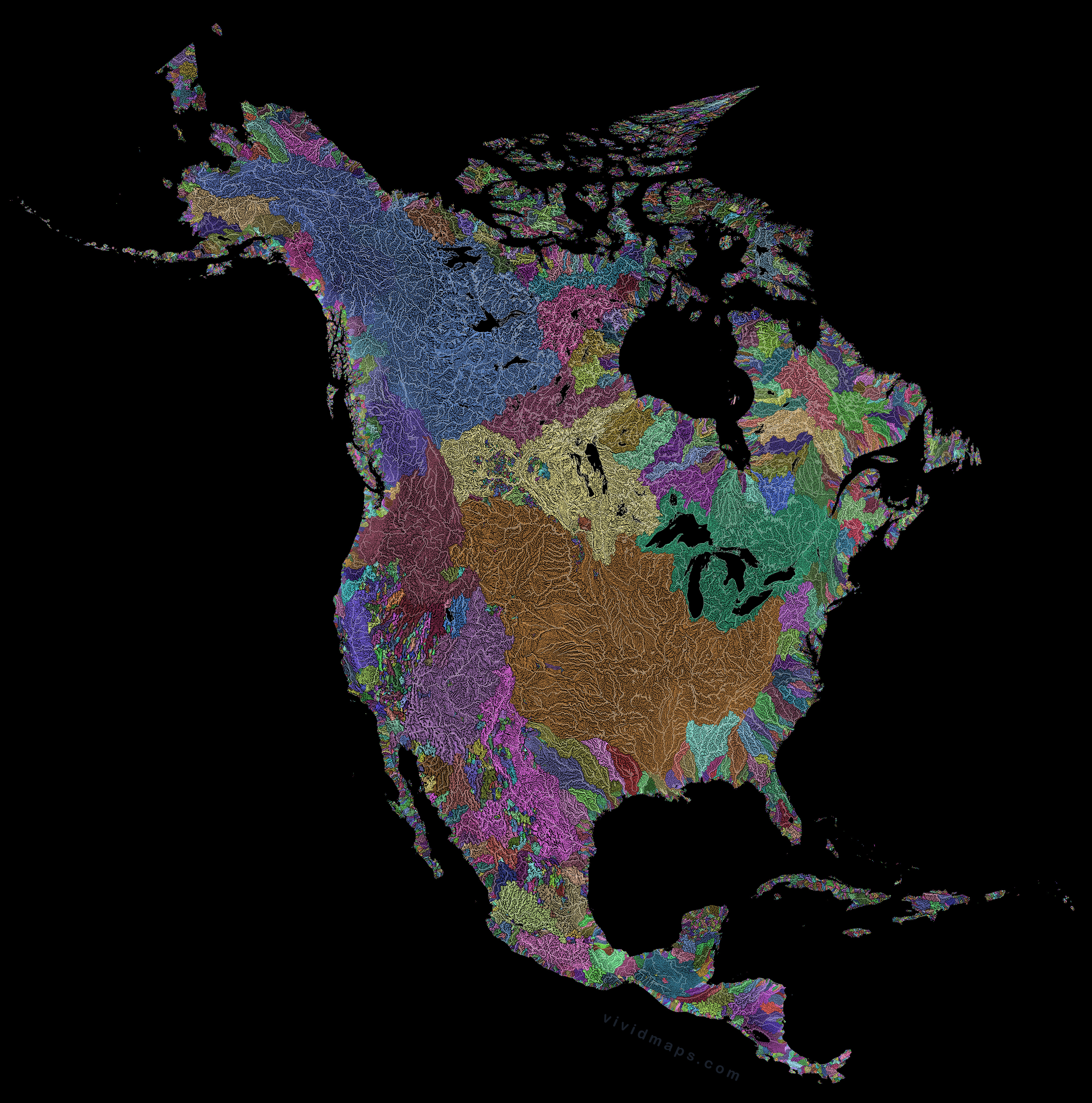
Here is the map of the rivers of North America that I created using Hydrosheds data.
The density of river networks in North America varies from north to south and east to west. In general, northern regions, characterized by colder climates and permafrost, have a less dense river network compared to the more temperate southern regions. Similarly, the eastern part of the continent, with its humid climate and frequent rainfall, features a denser river network than the arid and semi-arid western regions.
The Longest Rivers in North America
Mississippi-Missouri River System – 6,275 km (3,902 miles)
Mackenzie River – 4,241 km (2,635 miles)
Yukon River – 3,190 km (1,982 miles)
Rio Grande – 3,034 km (1,885 miles)
Colorado River – 2,333 km (1,450 miles)
The Mississippi River is the longest and most voluminous river in North America.
The Most Voluminous Rivers
Mississippi River – Average discharge: 16,792 m³/s
St. Lawrence River – Average discharge: 10,400 m³/s
Columbia River – Average discharge: 7,500 m³/s
Yukon River – Average discharge: 6,430 m³/s
Mackenzie River – Average discharge: 9,910 m³/s
Now, let’s turn our attention to North America’s largest river basins. These expansive regions, drained by major rivers and their tributaries, play a crucial role in the continent’s hydrology and support a wide range of ecosystems and human activities.
View the full-resolution versions of these map posters: 1, 2.
The Largest River Basins
Mississippi River Basin – 3.2 million km² (1.2 million sq miles)
Mackenzie River Basin – 1.8 million km² (695,000 sq miles)
St. Lawrence River Basin – 1 million km² (386,000 sq miles)
Yukon River Basin – 832,700 km² (321,500 sq miles)
Colorado River Basin – 637,137 km² (246,000 sq miles)
North America’s rivers are subject to various changes, both natural and human-induced. Climate change, for instance, affects precipitation patterns, leading to alterations in river flow and water availability. Urbanization and industrial activities contribute to pollution and habitat destruction, while dam construction modifies river courses and disrupts ecosystems. Efforts to mitigate these impacts include conservation initiatives, sustainable water management practices, and habitat restoration projects.
If you want to learn more about the rivers of North America, you’ll find these books and maps fascinating.


May I use the top map for an alternate history thing I’m doing?
Yes. You can use the map.
May I have permission to use the map to illustrate a research paper on unidentified aquatic megafauna in North America? Full attribution of, course.
Absolutely—you’re welcome to use the map in your research paper.