Global Remoteness
The maps are based on distance from cities, roads, railways, and airports. The green areas represent places where travel to the city, road and other transportation facilities can be measured in hundreds of kilometers.
Read More
The maps are based on distance from cities, roads, railways, and airports. The green areas represent places where travel to the city, road and other transportation facilities can be measured in hundreds of kilometers.
Read More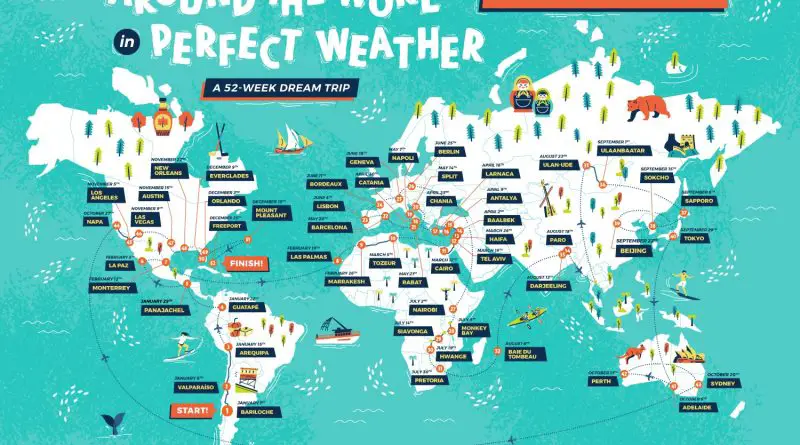
An around-the-world journey sounds like an out-of-reach, bucket list experience. But it’s achievable, and many people have done it – some in only eighty days. A map below shows a 52-week dream journey in perfect weather, between 70-75 °F, or 21-24 °C. It’s a comfort temperature amongst the majority of people.
Read More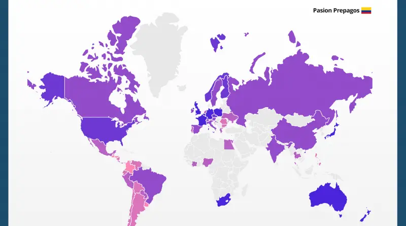
The Prostitution business makes US$186 billion per year. According to Economist, In 2006, the cost for one hour of sex with a female prostitute averaged $340 worldwide. Nowadays, the average rate is down to $260. Prostitution is legal in about 52% of the world, limitedly legal in 12%, and illegal in 35%.
Read More
The average height of individuals across Asian countries exhibits a diverse range, shaped by a multitude of factors such as genetics, nutrition, healthcare, and socio-economic conditions. Generally, Asians are not uniformly distributed in terms of height, and there is considerable variation among different populations.
Read More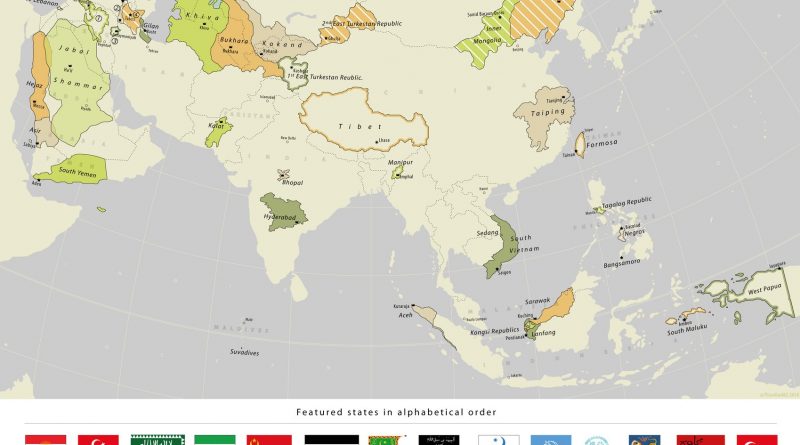
From the rugged mountains of Ararat to the lush islands of Southeast Asia, the map of Asia has undergone constant change. Join us as we uncover the fascinating stories of 33 former states that once dotted the Asian landscape, each with its unique tale of creation, struggle, and eventual fade into history.
Read More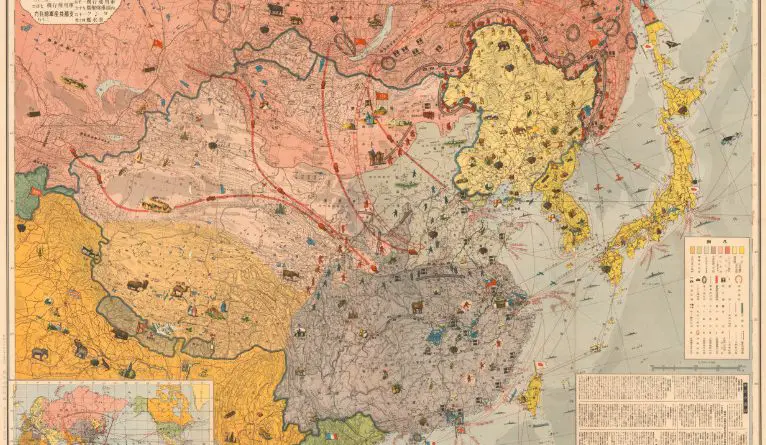
An in-depth examination of a 1937 map that captures the power struggle between Japan, China, and the USSR in East Asia, revealing the strategic tensions and resource rivalries that preceded World War II.
Read More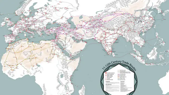
Medieval trade networks were a crucial aspect of the global economy during the Middle Ages, connecting different regions of the
Read More
Soviet views of Europe and Asia, captured in maps from Moscow and Irkutsk, reveal Cold War strategies and ambitions. See the story behind these historic maps.
Read More
How do forests and human settlements coexist? This article explores tree cover distribution, deforestation trends, and the patterns revealed by global maps.
Read MoreVicissitudes of history and variations of (geography on the Indian subcontinent have created an intricately patterned cultural fabric, woven but
Read More