Canada mapped only by rivers, streams & lakes
Vancouver Island and southern British Columbia Lake Manicouagan (Quebec) Southern Ontario Southern Saskatchewan & Alberta Great Slave Lake and Lake
Read More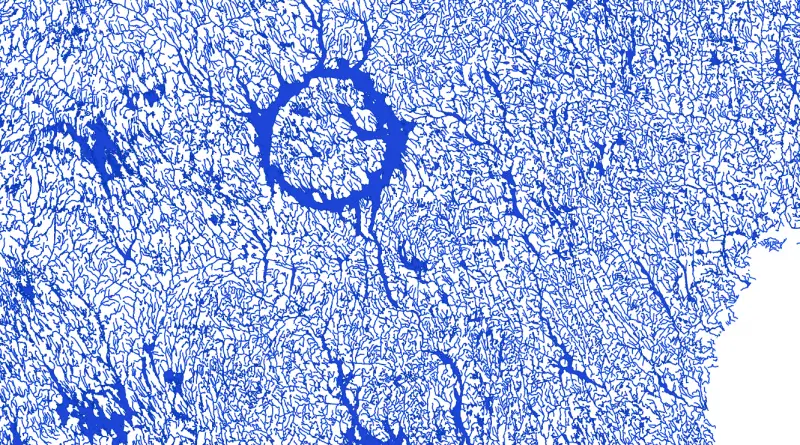
Vancouver Island and southern British Columbia Lake Manicouagan (Quebec) Southern Ontario Southern Saskatchewan & Alberta Great Slave Lake and Lake
Read MoreDid you know from 1890 to 1958 the British Columbia Electric Railway Co. Ltd. installed and operated interurban and streetcar
Read More
Related posts: – New York’s Subway Deserts – New York City boroughs journey to work-driving ca alone vs. walk/public transportation
Read More
Via etsy.com Related post: – The contiguous US mapped only by dirt trails, roads & highways
Read MoreNHALE is the first community air monitoring project in Canada. Jointly led by Environment Hamilton and Toronto Environmental Alliance with
Read MoreVia lincolninst.edu
Read MoreWithin the Downtown and East York regions of Toronto, during 2015 enforcement officers issued over $68.6 million in parking fines
Read MoreDouglas Copeland (1992)
Read More