Urbanization Levels in the United States
Reddit user: CG_America
Read MoreMaps of the US
Reddit user: CG_America
Read More
In 2017 high-profile insurance exits left 21 percent of all ACA customers with only one insurer in their area. This doesn’t even count 2018 when there could be as many as 47 U.S. counties with no insurer at all.
Read More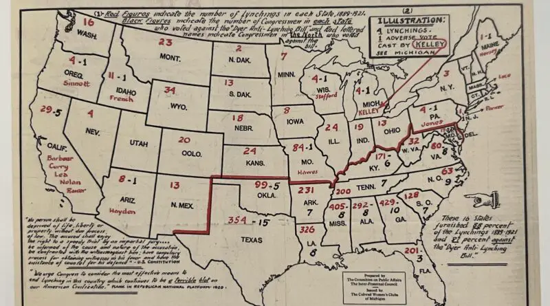
From 1883 to 1941, there were 4,467 sufferers of lynching. Of these, 4,027 were male, 99 female, and 341 were of unknown gender. Regarding ethnicity, 3,265 were black, 1,082 were white, 71 were Mexican or of Mexican origin, 38 were American Indian, 10 were Chinese, and 1 was Japanese.
Read More
The global sea-level rise started around the beginning of the 20th century. From 1900 to 2016, the average sea level on the planet rose by 16–21 centimeters or 6.3–8.3 inches. According to the extreme scenario, an increase in sea level can be presumed as 189 centimeters (6.2 feet) by 2100.
Read More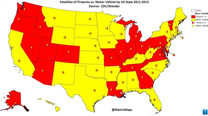
Related post: www.metricmaps.org/2017/06/12/fatalities-of-firearms-vs-motor-vehicle
Read Morevar divElement = document.getElementById(‘viz1497363671079’); var vizElement = divElement.getElementsByTagName(‘object’)[0]; if ( divElement.offsetWidth > 800 ) { vizElement.style.width=’629px’;vizElement.style.height=’769px’;} else if ( divElement.offsetWidth
Read More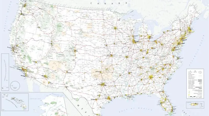
The U.S. boasts a vast and diverse transportation infrastructure that serves as the backbone of its economy and daily life. At the heart of this network is an extensive system of highways and roads, including the iconic Interstate Highway System, connecting cities and regions across the country. This highway network facilitates the movement of goods and people, supporting commerce, tourism, and daily commuting.
Read More
Rate of adherence to Lutheranism by U.S. county The following denominations are combined on this map: American Association of Lutheran
Read More
Reddit user: friendsknowusername
Read MoreThe ships weren’t necessarily abandoned – often a keeper was hired to keep an eye on them, Everett says but
Read More