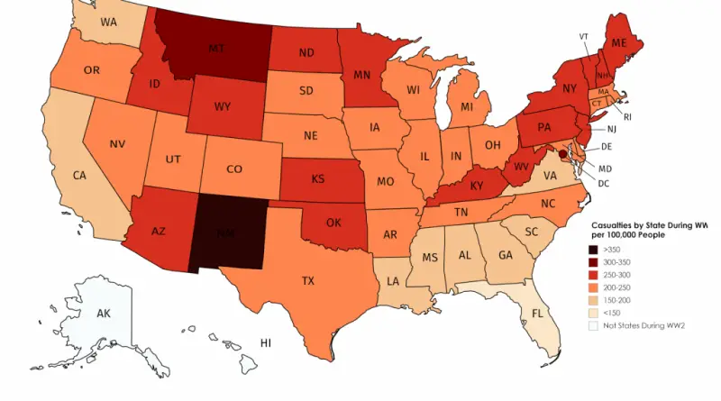
How many structurally deficient bridges are in the U.S.?
Donald Trump campaigned on a $1 trillion infrastructure plan that includes fixing the nation’s bridges. There are more than 130,000
Read MoreMaps of the US
Donald Trump campaigned on a $1 trillion infrastructure plan that includes fixing the nation’s bridges. There are more than 130,000
Read MoreWeekend vs. working days population density. Residents, per square kilometer Workday people, per square kilometer Via plumplot.co.uk
Read MoreThe Atlas of ReUrbanism is a tool to understand, support, and transform American cities. Developed by the Preservation Green Lab,
Read MorePicture: Reddit CopperWalrus
Read More
Related posts: – NYC by equivalent state population – ALSO an area in the U.S. with equivalent population of NYC
Read More
Picture: Reddit (BuddyWudd)
Read MoreThe map below created by oefiefieuwbe shows bigfoot sightings and black bear records.
Read More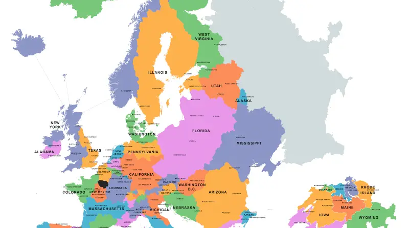
Reddit user: Speech500 Related post: – Countries that have a smaller GDP than California
Read More