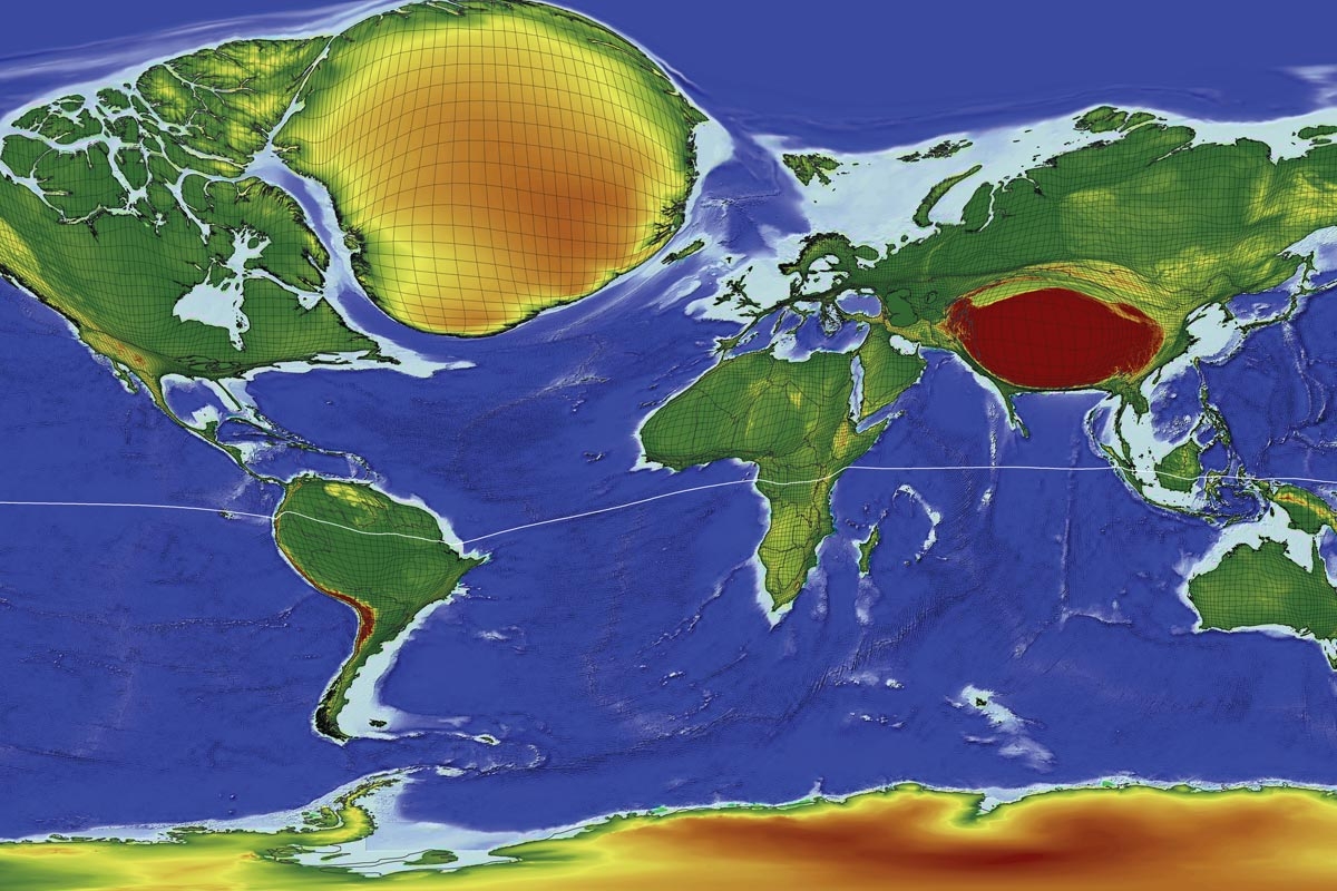
This cartogram shows the land surface transformed according to the
absolute travel time that is necessary to reach the nearest large city
using a gridded cartogram projection. The larger a grid cell appears,
the more remote it is, highlighting the least accessible spaces on the
planet (Antarctica has not been included in the transformation and
appears in its original shape).