Your fingernails grew a few centimeters this year, and so did the continents, in a manner of speaking. The USGS says plates move at roughly the pace of fingernail growth. That sounds like nothing until it is multiplied by 50 million years.
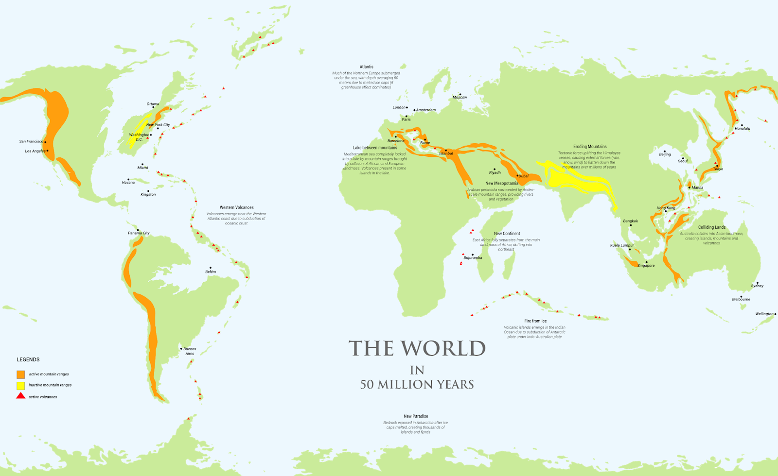
In 50 million years, Africa is projected to have pushed into Europe and closed off the Mediterranean, while Australia will have collided with Southeast Asia. These are estimates from geologist Christopher Scotese’s PALEOMAP projections, which extend today’s plate motion forward in time.
Key Takeaways
A plate moving at fingernail speed, about 3.6 cm (1.4 in) a year, covers roughly 1,800 km (1,118 mi) in 50 million years.
Africa keeps closing on Europe, and a mountain belt replaces the Mediterranean.
Australia keeps heading north into Southeast Asia.
Moving plates and melting ice are separate processes. Melting every ice sheet would raise the sea about 80 m (262 ft).
How fast do continents actually move?
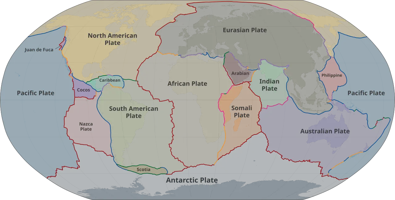
The USGS puts the Yellowstone region’s plate at about 4.6 cm (1.8 in) a year on average over the last 16.5 million years, and notes that fingernails grow about 3.6 cm a year.
What happens to the Mediterranean?
Italy, Greece and much of the Mediterranean floor ride on the African plate, which has been pressing into Europe for about 40 million years. The projection ends with a long mountain range running from Iberia across southern Europe into Asia. Great Britain drifts closer to the North Pole in the same model.
Where is Australia headed?
North. The continent is already colliding with the southern islands of Southeast Asia, and the model has it getting caught on Borneo and south China, much as India did. The Philippines and Indonesia get squeezed inland, and Japan collides with the mainland.
Will rising seas flood the map?
Ice and plates answer to different clocks. The USGS estimates that melting all ice on Earth would lift the sea about 80 m (262 ft), with Antarctica holding 91 percent of that ice and Greenland 8 percent. It also calls this an extreme scenario that is not expected. Other estimates run lower, near 68 m (223 ft), and Antarctica would then look like a mountainous archipelago.
Amazing maps for your home (Amazon affiliate links):