Most images of Antarctica show only the surface. These maps look underneath it.
The 3D relief model shows what the ice is resting on. Vinson Massif in the Ellsworth Mountains is the highest point on the continent at 4,850 metres (15,912 feet). The Bentley Subglacial Trench in West Antarctica drops to around 2,550 metres (8,366 feet) below sea level. Lake Vostok, buried under more than 4 kilometres of ice in the east, is the world’s largest known subglacial lake.
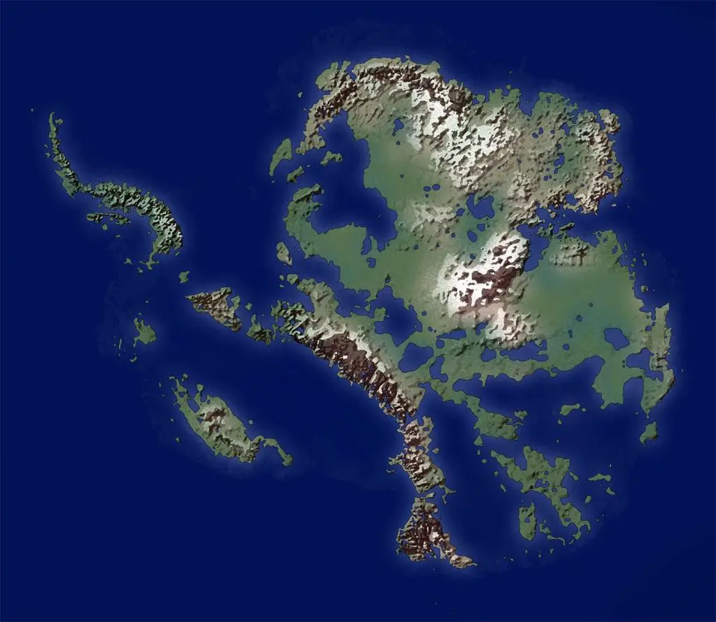
The map below shows Antarctica without ice.
Remove the ice and the continent splits into two very different places. East Antarctica stays largely above sea level, a rugged terrain of mountains and plains. In the west, most of the bedrock is below sea level. Without ice, it would fragment into a group of islands.
When ice melts, the land underneath is no longer compressed by the weight and begins to rise. In Antarctica this would take thousands of years. The map also accounts for the roughly 58-metre (190-foot) sea level rise the melt would produce. More of West Antarctica eventually re-emerges.









It’s a free use map?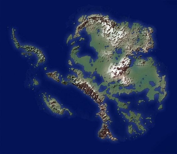
Yep
I like to ski in the Mountains of Madness.